 11
11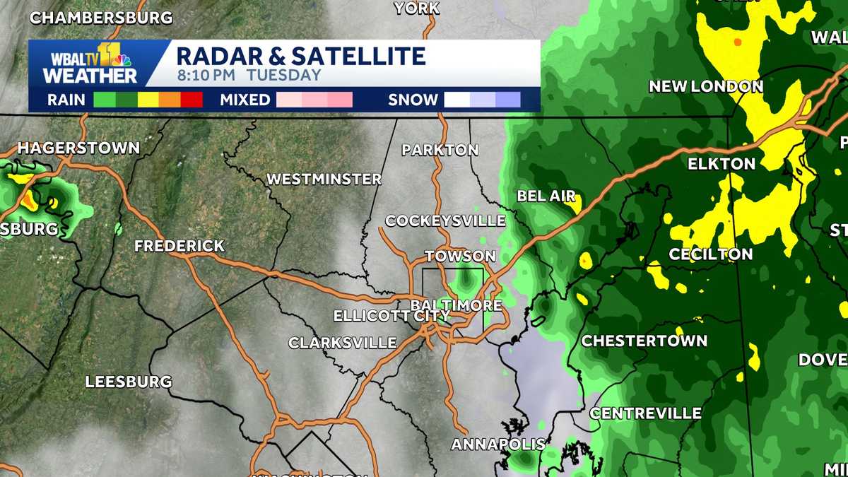
IMPORTANT ALERT
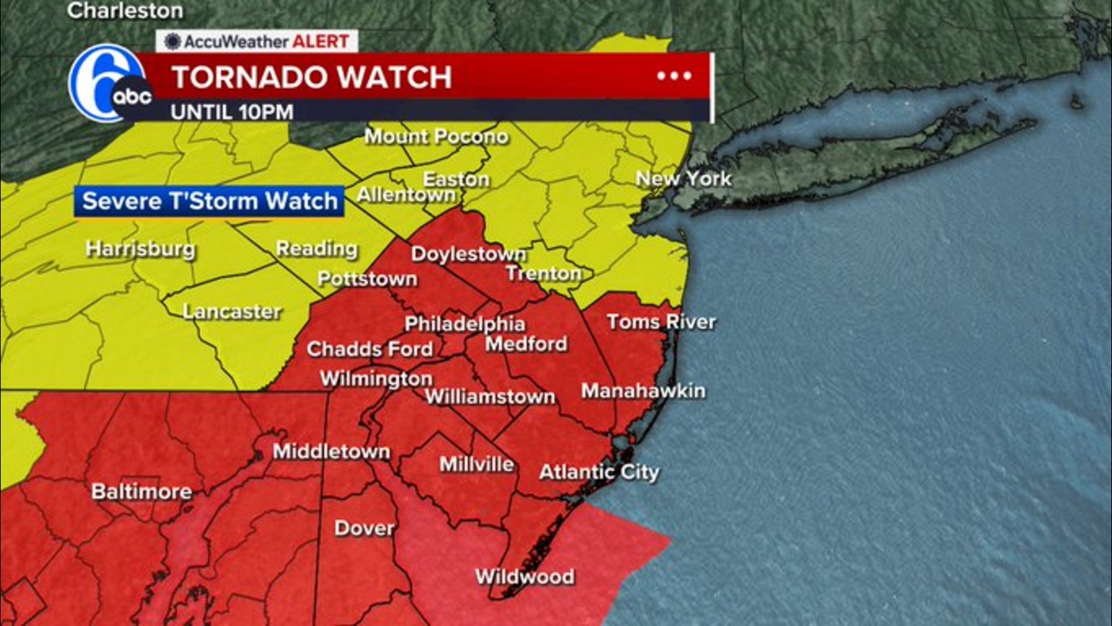
A Tornado Watch and Severe Thunderstorm Watch are in effect for much of Maryland until 10 PM Tuesday night. This is an Alert Day — meaning there is a threat of extreme, severe, and possibly life-threatening weather.
The National Weather Service has placed a large portion of Maryland under watches for:
The Storm Prediction Center (the national experts who forecast severe weather) has labeled much of Maryland with a "Slight Risk" — their second-lowest threat level, but still meaning severe storms are possible.
| Hazard | Likelihood | What It Means for You |
|---|---|---|
| Damaging Winds | Primary Concern | Winds strong enough to knock down trees, power lines, and damage buildings (58+ mph) |
| Large Hail | Possible | Hailstones 1 inch or larger (quarter-sized) that can dent cars, break windows, hurt people/pets |
| Tornadoes | Possible | A few tornadoes could form — especially in the strongest storms |
| Flash Flooding | Possible | Very heavy rain could cause rapid flooding of roads, low-lying areas, and streams |
Think of it like this: The atmosphere is like a shaken soda bottle. All the ingredients for severe weather are there — heat, moisture, and wind shear (winds changing speed/direction with height). The "cap" (a layer of warm air aloft) has been holding things down, but storms are now breaking through.
Chief Meteorologist Tom Tasselmyer:
"Storms are producing heavy downpours, lightning, and pockets of hail. Some areas could experience flooding."Meteorologist Tony Pann (via Twitter/X):
"Any clouds or showers in the Baltimore Metro this morning is a good thing. Why? It will help stabilize the atmosphere a little and reduce the threat for severe weather this afternoon. Storms are still possible though."
Translation: Morning clouds acted like a "lid" on the atmosphere, keeping it from getting too explosive. But the lid isn’t tight enough to prevent all storms.
WBAL-TV 11 Weather Team uses two labels. Here’s what they mean:
| Label | Meaning | What You Should Do |
|---|---|---|
| Impact Day | Weather will likely disrupt your normal routine (commute, outdoor plans, school sports) | Plan ahead, allow extra time, have a backup plan |
| Alert Day | Threat of extreme, severe, possibly life-threatening weather | Take action now. Have multiple ways to get warnings. Know your safe place. |
Today is an ALERT DAY. This is the highest level of urgency.
| Location | Best Shelter |
|---|---|
| House with basement | Basement, under sturdy table, away from windows |
| House NO basement | Interior room on lowest floor (bathroom, closet, hallway) — no windows |
| Mobile home | LEAVE IMMEDIATELY — go to nearest sturdy building or designated shelter |
| Car | Last resort only — drive to sturdy building. If stuck, stay in car with seatbelt on, head below windows |
| Outside | Lie flat in low ditch/ravine, cover head |
Storms can knock trees/limbs onto power lines. BGE (Baltimore Gas and Electric) asks customers to report outages:
When and WHERE SAFE, share your weather photos/videos with WBAL-TV 11:
| Resource | Link |
|---|---|
| MDOT SHA Traffic/Transportation Map | maryland.maps.arcgis.com |
| BGE Outage Map | bge.com/outage-map |
| WBAL-TV 11 News App | wbaltv.com/apps |
| Live Stream | wbaltv.com/nowcast |
| Current Alerts | wbaltv.com/alerts |
RIGHT NOW: Tornado & Severe Thunderstorm Watches until 10 PM Tuesday for most of Maryland
PRIMARY THREAT: Damaging winds (58+ mph), large hail, isolated tornadoes, flash flooding
TONIGHT: Storms fade after 10 PM, only leftover showers early Wednesday
WEDNESDAY: Beautiful day — mid-80s, dry, low humidity
ACTION ITEMS:
1. Enable weather alerts on phone (WBAL app + WEA)
2. Know your safe place — lowest floor, interior room, no windows
3. Charge devices & prep for outages
4. Never drive through floodwater
5. Report outages/downed lines to BGE: 877-778-2222
WATCH = "Be prepared." Conditions are favorable for severe weather. Covers a large area for several hours.
WARNING = "Take action NOW." Severe weather is occurring or imminent. Covers a smaller area (like a polygon) for 30-60 minutes.
Right now we have WATCHES. If a WARNING is issued for your location, GO TO YOUR SAFE PLACE IMMEDIATELY.
Yes, if they involve being outdoors, on the road, or in a vulnerable structure (mobile home, tent, etc.). If you’re already in a sturdy building with a safe place identified, you can stay put — but stay alert and have alerts ON.
Yes, and they’re especially dangerous because they’re harder to see and people are asleep. This is why having phone alerts that wake you up (WEA, WBAL app) is critical tonight.
Not necessarily. The watch covers a large area and storms are moving/developing. Conditions can change fast. Stay alert until the watch expires at 10 PM.
Get off the road and into a sturdy building (gas station, restaurant, store). If no shelter available:
- Tornado: Stay in car, seatbelt on, head below windows, cover with blanket/coat
- Flash flood: Abandon car immediately if water is rising — climb to higher ground
Never park under an overpass.
Remember: This will pass. By Wednesday afternoon, it’ll be a beautiful Maryland summer day. Until then — stay weather-aware, stay safe, and look out for each other.
Information sourced from WBAL-TV 11 Weather Team, National Weather Service, Storm Prediction Center, and BGE. Article formatted for clarity and safety.