 11
11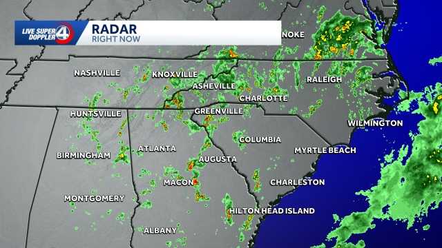
Expect daily afternoon showers and thunderstorms through early next week. No day will be a total washout, but keep an umbrella handy! Temperatures will stay slightly cooler than normal before heating up again.
KEY TAKEAWAYS
- No "washout" days – you’ll still have dry hours each day
- Afternoon timing – storms most likely after lunchtime
- Wind is the main concern with any stronger storms
- Below-average highs feel pleasant compared to typical August heat
- Heat returns next week – enjoy the break while it lasts!
The WYFF News 4 Weather Team has been independently certified as the MOST ACCURATE in the Greenville-Spartanburg-Asheville-Anderson market for TWO YEARS IN A ROW!
How they’re verified:
"Forecasting here is tough with mountains and Upstate terrain – but Chris Justus and his team get it right more than anyone else."
— Bruce Fixman, WeatheRate President
| What | When | Impact | Action |
|---|---|---|---|
| Daily afternoon storms | Wed – Early next week | Brief heavy rain, gusty winds | Carry umbrella, plan outdoor AM |
| Below-average highs | This week | Comfortable temperatures | Enjoy the break from heat! |
| Heat returns | Late next week | Hot, humid conditions return | Prep AC, hydrate early |
Bottom line: It’s a classic summer pattern – storms pop up each afternoon like clockwork. Mornings stay nice, afternoons get stormy. No severe weather outbreak expected, just your typical August afternoon thunderstorms.
No! The forecast specifically says "no day is a washout." Expect dry mornings and stormy afternoons – typical summer pattern.
There’s a low chance of severe storms. The main risk is strong straight-line winds (not tornadoes or large hail). Think 40-60 mph gusts in the strongest cells.
Mornings through early afternoon (before 2-3 PM). Storms typically fire up during peak heating (2-6 PM).
Cloud cover and rain keep the sun from heating the ground as much. Highs might only reach upper 80s instead of low-mid 90s. Enjoy it!
Use the Weather Alerts link and enter your zip code, or download the WYFF 4 app for push notifications tailored to your location.
Forecast provided by Chief Meteorologist Chris Justus and the WYFF News 4 Weather Team – Your certified most accurate forecast in the Carolinas.