Des Moines Dodges Tornado Threat: Warnings Expire, Storms Rage On
Tornado Warnings Expire in Des Moines Area: What Happened and How to Stay Safe
Updated August 13, 2026 • 7:24 AM CT
What Happened This Morning?
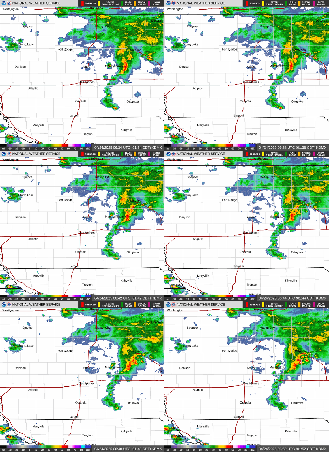
Early today, the National Weather Service issued two tornado warnings for the Des Moines metro area. These warnings covered parts of Polk, Story, and Marshall counties. The warnings were issued because strong thunderstorms moving through the area were capable of producing tornadoes.
GOOD NEWS: Both tornado warnings have now expired or been canceled. No tornadoes were confirmed to have touched down in the warned areas.
What’s Still Happening Right Now?
Severe Thunderstorm Watch Continues
A Severe Thunderstorm Watch remains in effect for a large portion of Iowa — stretching from Des Moines through southeast Iowa — until 11:00 AM today.
What this means: Conditions are still favorable for dangerous storms with strong winds, large hail, and possibly brief tornadoes. Stay alert!
Power Outages Reported
MidAmerican Energy reports about 3,000 customers without power across Iowa after the storms:
- ~1,300 customers in West Des Moines
- ~1,300 customers in the Sioux City area
- Additional outages scattered elsewhere
IMPORTANT: Crews are working to restore power. Check the MidAmerican Energy outage map for real-time updates.
Tornado Safety: What You Need to Know
If You’re at Home or in a Building
Follow these steps immediately when a tornado warning is issued:
- Get as low as possible — Go to a basement if you have one
- No basement? Go to the lowest floor of the building
- Put walls between you and outside — Interior rooms (bathrooms, closets, hallways) are best
- Stay away from windows — Flying glass is extremely dangerous
- Protect your head — Use a helmet, pillow, or your arms
REMEMBER: The goal is to be underground or as close to it as possible, with maximum walls between you and the storm.
If You’re Driving When a Tornado Warning Is Issued
DO NOT try to outrun a tornado in your car. Tornadoes can change direction suddenly and move faster than you can drive.
Instead, follow this plan:
| Priority | Action |
|---|---|
| 1st Choice | Safely exit the road and find a sturdy building (gas station, restaurant, store) |
| 2nd Choice | If no building is reachable, pull over, keep seatbelt on, duck below window level |
| Last Resort | Lie flat in a ditch, culvert, or low spot — cover your head with arms |
NEVER seek shelter under an overpass or bridge. Wind speeds increase there and debris flies through!
Watch vs. Warning: What’s the Difference?
This is one of the most important weather concepts to understand!
| Tornado WATCH | Tornado WARNING |
|---|---|
| Conditions are right for tornadoes to form | A tornado is happening NOW or imminent |
| "Be prepared" — Stay alert, have a plan | "Take action NOW" — Seek shelter immediately |
| Can last several hours | Usually lasts 30–60 minutes |
| Tornado may never form | Tornado has been spotted or indicated by radar |
SIMPLE WAY TO REMEMBER:
- Watch = Watch out (pay attention)
- Warning = Warning! (danger is here, act now)
Stay Informed: Get Alerts Directly to Your Phone
Don’t rely on just one source for weather alerts. Here are the best ways to stay informed:
- Enable Wireless Emergency Alerts (WEA) on your smartphone — these are free, automatic, and work even without apps
- Download a weather app with push notifications (NOAA Weather Radar, WeatherBug, or your local news station’s app)
- Sign up for text alerts from the Des Moines Register: Join Subtext Weather Watch
- Follow @NWSDesMoines on Twitter/X for real-time updates
- Keep a NOAA Weather Radio in your home (battery-powered for outages)
Live Weather Tools
- Des Moines Area Radar Loop: View Current Radar
- Iowa Weather Watches & Warnings Map: Interactive Map
- Power Outage Tracker: MidAmerican Energy Map
Summary: Key Takeaways
| What Happened | What’s Active Now | What You Should Do |
|---|---|---|
| 2 tornado warnings issued for Des Moines metro | Severe Thunderstorm Watch until 11 AM | Review your shelter plan |
| Warnings expired/canceled — no confirmed touchdowns | ~3,000 MidAmerican customers without power | Enable emergency alerts on phone |
| Storms moving east across Iowa | Storms continuing across southeast Iowa | Check radar if traveling today |
Frequently Asked Questions (FAQ)
1. The tornado warning expired — does that mean I’m completely safe?
Not necessarily. The tornado threat has passed for now, but the Severe Thunderstorm Watch continues until 11 AM. Storms can still produce damaging winds (60+ mph), large hail, and brief spin-up tornadoes. Stay alert until the watch expires.
2. My power is out — what should I do?
- Report it to MidAmerican Energy at 800-799-4443 or via their app/website
- Keep refrigerator/freezer doors closed (food stays safe ~4 hours in fridge, ~48 hours in full freezer)
- Use flashlights — avoid candles (fire risk)
- Never run generators indoors or in garages (carbon monoxide danger)
- Check on neighbors, especially elderly or vulnerable people
3. I live in a mobile home — where should I go during a tornado warning?
Mobile homes are NOT safe during tornadoes, even if tied down. Leave immediately and go to:
- A designated community storm shelter
- A nearby sturdy building (friend’s house, community center, store)
- Have a plan BEFORE storms hit — know exactly where you’ll go and how long it takes to get there
4. How can I tell if a storm is producing a tornado if I can’t see one?
Look for these signs:
- Rotating, lowering cloud base (wall cloud)
- Loud, continuous roar (like a freight train)
- Debris swirling on the ground under a cloud base
- Bright blue-green flashes at ground level (power lines snapping)
- BUT: Many tornadoes are rain-wrapped and invisible. Always trust the warning, not your eyes!
5. What’s the difference between a Severe Thunderstorm Warning and a Tornado Warning?
- Severe Thunderstorm Warning: Storm producing hail ≥1 inch and/or winds ≥58 mph. Dangerous, but no rotation detected.
- Tornado Warning: Rotation detected on radar OR tornado spotted. Immediate life-threatening danger. Both require shelter, but tornado warnings demand the highest level of protection (lowest floor, interior room, head covered).
About This Report
Brian Smith, Senior Editor and Audience Strategist at the Des Moines Register, compiled this report.
Contact: bsmith@dmreg.com
Stay safe, Iowa! Remember: When thunder roars, go indoors. When a warning sounds, take cover!