 11
11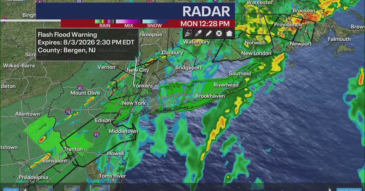
IMPORTANT: The National Weather Service (NWS) has issued flood watches and flash flood warnings for all of New York City and northern New Jersey. This means dangerous flooding is possible (watch) or already happening/imminent (warning).
Think of it like this: Mother Nature is planning to dump a lot of water on the Tri-State Area (that’s New York, New Jersey, and Connecticut) on Monday. Multiple rounds of heavy rain and thunderstorms are coming through, and the ground can only soak up so much before it starts pooling in streets, basements, and low-lying areas.
Most areas: Expect between ¾ inch to 1½ inches of rain total.
But some unlucky spots (northeast New Jersey, NYC, the Lower Hudson Valley, and southwest Connecticut) could see nearly 3 inches — that’s like dumping a big bucket of water over your head all day long.
| Alert | Level | What It Means For You |
|---|---|---|
| Flash Flood Threat | Level 2 out of 4 | "Moderate" risk — flooding is likely in some areas. Take it seriously. |
| Severe Weather Threat | Level 1 out of 4 | "Marginal" risk — damaging wind gusts could happen with storms. |
The flood watch stays in effect until 8 p.m. Monday.
Especially if you live in a flood-prone area or a basement apartment:
PRO TIP: "Turn Around, Don’t Drown" — just 6 inches of moving water can knock you down, and 12 inches can float a car. You can’t tell how deep water is just by looking.
| Day | Forecast |
|---|---|
| Monday | Heavy rain, thunderstorms, flood threat — the bad day |
| Tuesday | Nice! High pressure moves in — enjoy the break |
| Wednesday–Friday | Pop-up showers possible each day — keep an umbrella handy |
All details come from trusted sources:
Watch = conditions are right for flooding; be prepared. Warning = flooding is happening or will very soon; take action now.
If you’re in a known flood-prone area, yes — move to a higher floor or safer location before heavy rain begins. Don’t wait for water to come in.
Only if absolutely necessary. Check real-time road conditions (511NY, Waze, local news). Never drive through standing water — it’s deeper and stronger than it looks.
It’s a "moderate" risk level. Flooding is likely in some areas, especially low spots, poor-drainage zones, and near streams. It’s not the highest level, but it’s serious.
Forecast models agree: a high pressure system builds in Tuesday, bringing dry, pleasant weather. Enjoy it — but keep the umbrella for Wednesday onward!