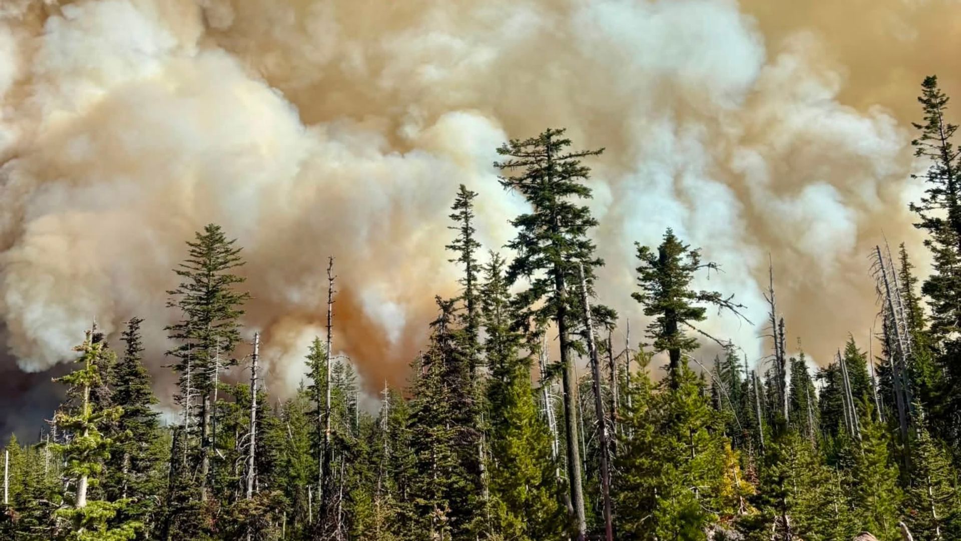
Massive Grasshopper Fire Forces Emergency Evacuations Near Mount Hood
What’s Happening Right Now
A huge wildfire called the Grasshopper Fire is burning near Mount Hood in Oregon. As of Tuesday morning, the fire has grown to 34,659 acres — that’s bigger than 26,000 football fields put together! The fire is only 19% contained, which means firefighters have control over less than one-fifth of the fire’s edge.
IMPORTANT ALERT: LEVEL 3 "GO NOW" EVACUATION IN EFFECT
Mt. Hood Meadows and surrounding areas are under the highest evacuation level. Leave immediately if you are in this zone. Do not wait. Do not pack. Just go.
Who’s Fighting the Fire
Nearly 1,300 firefighters and support personnel are working around the clock to control this blaze. They’re coordinating with the U.S. Forest Service and local sheriff’s offices to keep people safe.
Why It’s Getting Worse: Dangerous Weather
A Red Flag Warning is in effect — this is like a "high alert" for fire danger. Here’s what’s making things tough:
- Hot and dry conditions — much worse than previous days
- Strong easterly winds — blowing from the east toward the west
- Winds picking up through Tuesday afternoon — pushing fire onto ridges above Highway 35
These winds pushed the fire toward Mount Hood Meadows and Bennett Pass on Monday and Tuesday morning.
Where the Fire Started
- Date: July 23
- Location: About 4 miles northwest of Sportsmans Park in Wasco County
- Cause: Unknown, but lightning is suspected
Evacuation Orders: Know Your Level
Oregon uses a 3-level evacuation system. Here’s what each level means in simple terms:
Level 3 — GO NOW (Leave Immediately!)
Danger is happening RIGHT NOW or about to happen.
- Leave immediately
- Don’t grab belongings
- Follow emergency personnel instructions
- Current Level 3 Areas:
- Mt. Hood Meadows
- Hood River Meadows
- Bennett Pass
- Lookout Mountain
- Palisade Point
- Gunsight Butte
- Badger Butte
- Elk Mountain
- Tamanawas Falls
- South of Forest Road 44 to Highway 35
- South of upper Cooper Spur at Highway 35, west to south of milepost 63 on Highway 35
Level 2 — BE SET (Get Ready to Go)
Significant danger in your area. Be packed and ready to leave at a moment’s notice.
- Voluntarily relocate now OR be ready to leave instantly
- Emergency services may NOT be able to warn you if things get worse fast
- Current Level 2 Areas:
- Mill Creek Buttes
- White River
- West of Highway 35 between milepost 77 (north) and south upper Cooper Spur Road
- Cooper Spur Ski Resort
- Cooper Spur Road
Level 1 — BE READY (Stay Alert)
Danger exists in the area. Stay informed and prepare.
- Monitor local news and official sources
- People with special needs should start evacuation arrangements now
- Evacuation is voluntary at this stage
- Current Level 1 Areas:
- West from Culbertson Road to Laurence Lake
- Milepost 80.5 (north) to milepost 77 (south)
What You Should Do Right Now: 5 Steps
- CHECK YOUR LOCATION — Find out which evacuation zone you’re in using the perimeter map
- IF LEVEL 3 — LEAVE NOW — Don’t wait, don’t pack, just go
- IF LEVEL 2 — PACK YOUR "GO BAG" — Medications, important documents, phone charger, pet supplies, clothes for 3 days
- PLAN YOUR ROUTE — Know at least 2 ways out of your area
- STAY INFORMED — Follow official sources (not social media rumors)
Sheriff’s Office Advice
The Hood River Sheriff’s Office says: "Start thinking about evacuation plans NOW. Know where you’d go, what you’d take, and how you’d get out. Fire conditions can change quickly and without warning."
Summary
The Grasshopper Fire has exploded to nearly 35,000 acres near Mount Hood with only 19% containment. Level 3 "Go Now" evacuations are active for Mt. Hood Meadows and surrounding communities. Dangerous Red Flag conditions (hot, dry, windy) are making the fire spread faster. Nearly 1,300 firefighters are battling the blaze that started July 23 from a suspected lightning strike. If you’re in a Level 3 zone — leave immediately. If you’re in Level 2 — be packed and ready. If you’re in Level 1 — stay alert and prepare.
Frequently Asked Questions
How big is 34,659 acres really?
Think of it this way: One acre is about the size of a football field. So this fire has burned an area larger than 26,000 football fields — or roughly 54 square miles. That’s bigger than the entire city of Beaverton, Oregon!
What does "19% contained" actually mean?
It doesn’t mean the fire is 19% out. It means firefighters have built control lines (cleared paths, dug trenches, used natural barriers) around 19% of the fire’s perimeter. The other 81% is still free to spread.
Why can’t they just put it out with water?
Wildfires this size create their own weather. The heat is so intense it creates updrafts that pull in oxygen, making the fire burn hotter and faster. Water dropped from planes helps, but it’s like spraying a garden hose on a bonfire — it slows it down but won’t stop it alone. Firefighters need to remove fuel (trees, brush) ahead of the fire to stop it.
What should I put in a "Go Bag" for wildfire evacuation?
Essentials only — keep it light:
- Phone + charger + portable battery
- Medications (7-day supply)
- Important documents (ID, insurance, deeds) in waterproof bag
- 3 days of clothes + sturdy shoes
- Water + non-perishable snacks
- Pet supplies (food, leash, carrier, vet records)
- Cash + credit cards
- Flashlight + extra batteries
- Paper map (GPS may not work)
How do I find out if my specific address is in an evacuation zone?
- Check the official perimeter map: perimetermap.com/wascocounty-or
- Sign up for local emergency alerts at oralert.gov
- Follow Hood River Sheriff’s Office and Wasco County Emergency Management on social media
- Call 211 for non-emergency evacuation information
- When in doubt — leave early. It’s always safer to evacuate before you’re told to.
Stay safe. Follow official orders. Things can be replaced — you cannot.
 1
1