
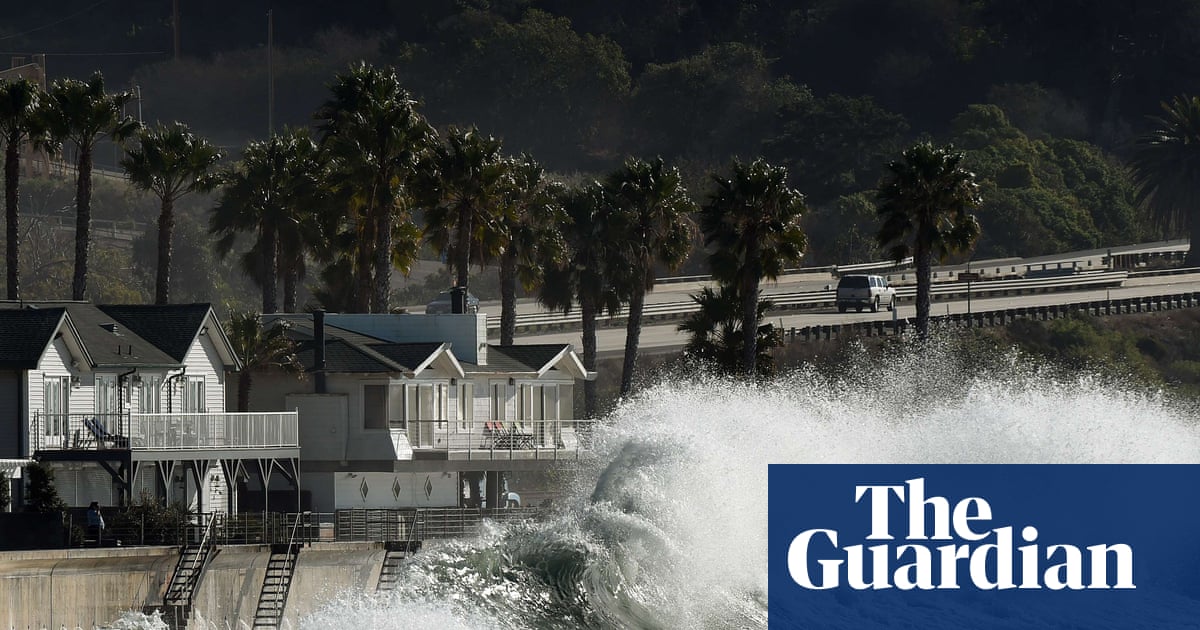
Climate Scientists Sound Alarm: Super El Niño to Unleash Western Deluge
Super El Niño Coming: What It Means for You (Explained Simply)
Imagine the Pacific Ocean is like a giant bathtub. Normally, strong winds push the warm water toward Asia. But every few years, those winds relax or reverse. The warm water sloshes back toward the Americas. That is El Niño.
This year, scientists say we are getting a "Super" El Niño—one of the strongest ever recorded. Here is what you need to know, without the confusing jargon.
What Is Happening Right Now?
- The Trigger: Trade winds (the usual steady breezes) have weakened.
- The Result: A massive pool of hot water is spreading across the central and eastern Pacific.
- The Label: When the ocean surface gets 2°C (about 3.6°F) hotter than normal, it earns the "Super" title.
- The Timeline: It will peak in fall and winter 2026, lasting until early spring 2027.
- The Source: The US National Oceanic and Atmospheric Administration (NOAA) and the European Centre for Medium-Range Weather Forecasts agree: this could be the strongest El Niño of the century.
Important Point: El Niño is a natural climate cycle. It happens every 2–7 years. But this one is unusually strong, and a hotter planet makes its impacts worse.
Why Should You Care? (The Impacts)
California & The West Coast: Wet & Dangerous
- Rain Odds: 70–100% chance of above-average rainfall on the coast.
- The Risk: It’s not just rain. It’s flooding, landslides, and crumbling cliffs.
- History Repeats:
- 1982–83: 33 homes destroyed, 3,000 damaged.
- 1997–98: Massive floods, 17 deaths.
- 2015–16: Record beach erosion (sand washed away).
- Why Worse Now? Beaches are already stripped of sand. With no buffer, waves hit cliffs and streets directly.
Callout: "El Niño never guarantees a specific outcome," says UCLA climate scientist Daniel Swain. "But a super El Niño loads the dice for a very wet, hazardous winter."
Gulf Coast & Southeast: Storms & Tornadoes
- Region: Florida up through the Mid-Atlantic.
- Threat: More severe thunderstorms, tornadoes, and flash floods.
- Proof: The 1998 El Niño winter spawned deadly tornadoes in Florida—42 deaths, $100M+ in damage.
The Southwest Drought: No Easy Fix
- Hope: Heavy rain could fill reservoirs (Lake Mead, Lake Powell).
- Reality: It would take "exceptionally wet" conditions—the kind that cause catastrophic flooding and loss of life.
- Verdict: Don’t count on El Niño to end the megadrought.
The Silver Lining: A "Stress Test" for the Future
Scientists see a hidden opportunity. Mark Merrifield (Scripps Institution of Oceanography) puts it perfectly:
"This Super El Niño gives us a temporary preview of future sea-level rise. It shows us exactly where our roads, homes, and infrastructure will flood permanently in 20–30 years."
Think of it as a fire drill for climate change. It reveals:
- Which cliffs are unstable.
- Which storm drains can’t handle the flow.
- Which communities need evacuation plans now.
How to Prepare: 5 Steps for Everyone
- Check Your Flood Risk: Look up your address on FEMA Flood Maps or local county tools.
- Clean Gutters & Drains: Do it before the first big storm. Blocked drains = flooded homes.
- Review Insurance: Standard home insurance does not cover flooding. You need a separate NFIP policy (takes 30 days to activate).
- Make a "Go Bag": Pack essentials (meds, docs, cash, charger, water) in case you must leave in 10 minutes.
- Know Your Evacuation Route: Don’t wait for the order to figure out which road to take.
Summary
| Topic | Key Takeaway |
|---|---|
| What is it? | A natural warming of the Pacific Ocean; this one is historically strong ("Super"). |
| When? | Peaking Winter 2026, ending Spring 2027. |
| Biggest Threat | Coastal flooding & erosion (West Coast), Tornadoes & flash floods (Gulf/Southeast). |
| Drought Relief? | Unlikely. Needed rain volume would cause disasters. |
| Why it Matters | It’s a real-world simulation of future sea-level rise—a chance to fix vulnerabilities now. |
FAQ: Your Questions Answered
1. Is El Niño caused by climate change?
No. It is a natural cycle that has happened for thousands of years. However, climate change acts like a steroid—it makes the ocean hotter to begin with, so El Niño’s impacts (heat, rain, sea level) are amplified.
2. Does "Super El Niño" mean it will rain every day in California?
Not at all. It means the odds favor a wetter-than-average season. You can still have dry weeks. But when storms do hit, they carry more moisture and hit harder.
3. I live in Arizona/Nevada. Am I safe?
Not necessarily. While the core wet signal hits the coast, the atmospheric river storms that hit California often move inland, causing flash flooding in deserts and heavy snow in the Rockies (which does help the Colorado River long-term).
4. What are "King Tides" mentioned in the article?
King Tides are the highest high tides of the year, caused by the alignment of the sun, moon, and earth. During a Super El Niño, higher sea levels + King Tides + big storm waves = guaranteed coastal flooding even without rain.
5. Should I panic?
No. Panic freezes action. Prepare instead. This is a forecast, not a fate. Communities that plan early (sandbags, drainage fixes, evacuation drills) fare dramatically better than those that wait.
Stay informed. Check your local National Weather Service office (weather.gov) for watches and warnings all winter. A prepared neighbor is a resilient community.