 11
11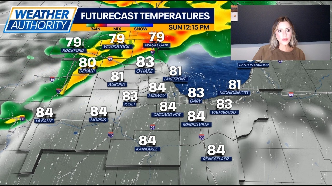
IMPORTANT ALERTS ACTIVE RIGHT NOW
- Severe Thunderstorm Watch – Lake and McHenry counties until 2:00 PM Sunday
- Severe Thunderstorm Warning – Parts of Chicago, Cook County, DuPage County, and Kendall County until 2:00 PM Sunday
- Ground Stop at O’Hare Airport – All flights paused until 1:30 PM Sunday due to thunderstorms (per FAA)
Think of the atmosphere over Chicago like a shaken-up soda bottle—lots of energy building up, ready to pop. Fox Chicago Meteorologist Kaitlin Cody says we’re looking at multiple rounds of storms today, not just one quick shower.
All hazards are on the table:
| Time | What to Expect |
|---|---|
| Morning | Increasing clouds, warming up |
| Midday → Afternoon | First round of storms possible |
| Late Afternoon → Tonight | Second round – higher flood risk |
| High Temp | Mid 80s (°F) |
ELI5 Explanation: "Mid 80s" means around 84–86°F—warm enough for shorts, but the humidity makes it feel stickier. The storms are fueled by that warmth + moisture.
KEEP THESE HANDY ALL WEEK
- Enable weather alerts on your phone (Settings → Notifications → Emergency Alerts)
- Have multiple ways to get warnings – phone, TV, weather radio, app
- If a WARNING is issued (not a watch): Go indoors immediately, stay away from windows
- Never drive through flooded roads – 6 inches of water can knock you down, 12 inches can float a car
- Secure outdoor items (patio furniture, trampolines, grills) before storms hit
- Check on neighbors – especially elderly or those with mobility issues
- O’Hare travelers: Check your flight status constantly; delays/cancellations likely
Chicago is in for a stormy stretch starting today (Sunday, Aug 9) through at least Wednesday.
Bottom line: Keep your umbrella handy, your phone charged, and your eyes on the sky. This pattern is stuck like a broken record—storms every afternoon/evening until the pattern breaks late week.
A: Think of it like baking cookies:
A: The ground acts like a sponge. Morning/afternoon storms soak it. By evening, the sponge is full—so any additional rain has nowhere to go but streets, basements, and low spots.
A: Have a Plan B (indoor backup). Mornings might be okay, but afternoons/evenings are highest risk. Check radar before heading out.
A: No planes take off or land until it’s lifted (1:30 PM today, but could extend). Even after it lifts, expect delays and cancellations as airlines catch up. Check your airline app constantly.
A: Friday looks like the first mostly dry, mostly sunny day. But—rain chances return Friday night. True "pattern break" likely next weekend.