San Antonio Weather: A Super Simple Guide to the Dry Spell and Coming Rain
What Has the Weather Been Doing Lately?
Imagine the sky as a giant sprinkler. For a while, it watered San Antonio a lot, then it turned off.
- From April 1 through June 20, San Antonio recorded 19.84 inches of rainfall. That’s more than double the usual amount (8.74 inches) for that period—like getting two big cups of water instead of one.
- Since June 20, not a single measurable drop has fallen. As of Wednesday, the city’s dry streak reached 18 days. That’s over two weeks with no rain!
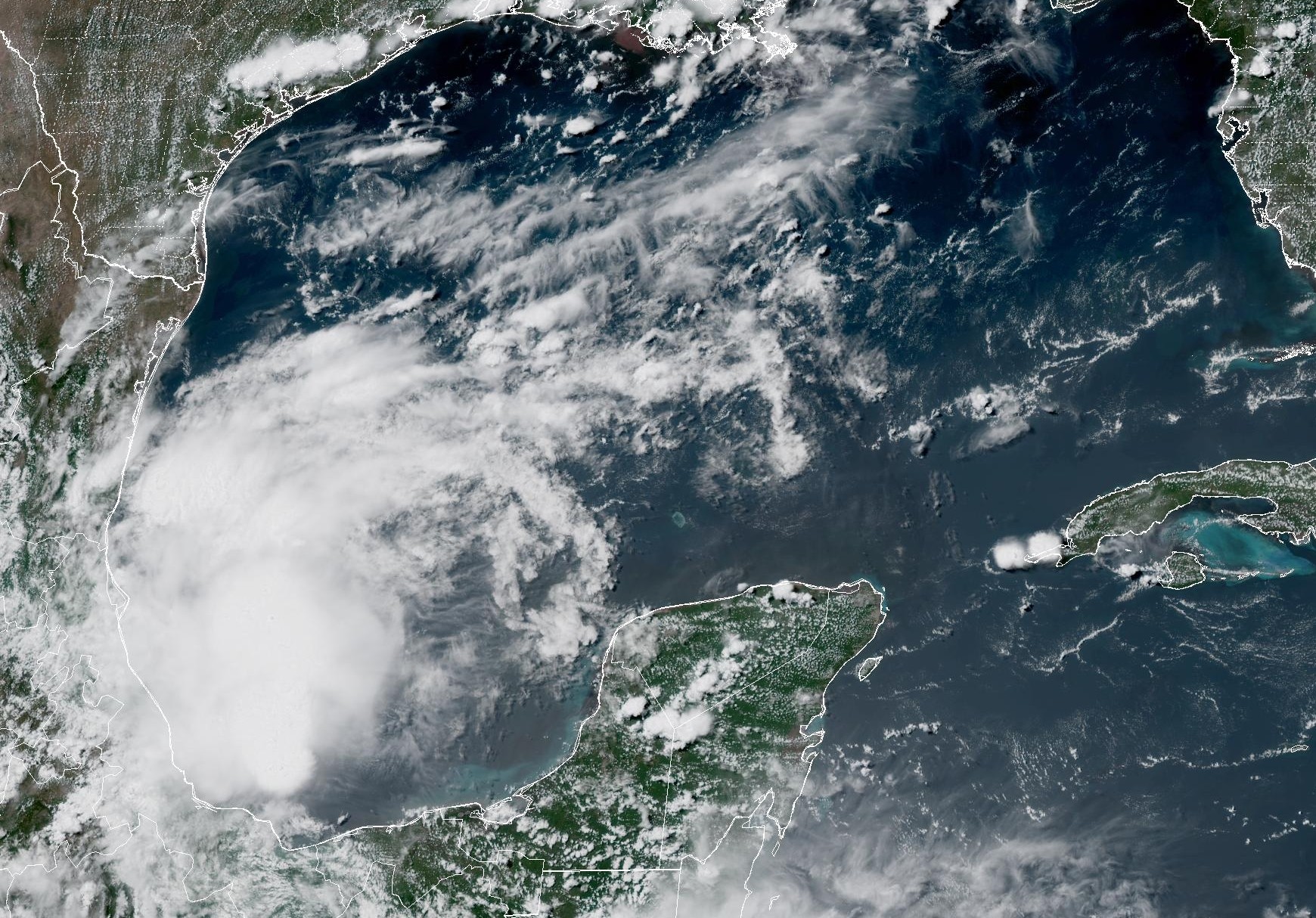
- A picture from NOAA (a weather science group) shows a weak atmospheric disturbance (a small swirl of air) in the western Gulf of Mexico. This swirl will move north and bring scattered showers and storms into South Texas on Friday and through the weekend.
Important: San Antonio has been very dry for 18 days, but a change is coming that may bring its best rain chances in weeks.
A Weak Disturbance From the Gulf Is Coming
A “weak atmospheric disturbance” is just a fancy name for a small twist of air in the sky that can carry clouds and rain. Think of it like a gentle eddy in a stream that picks up tiny water droplets. Here’s how it will affect us, step by step:
- A small weather swirl forms over the warm Gulf of Mexico (the big ocean south of Texas).
- It slowly travels northward toward Texas.
- As it moves, it pulls moist, tropical air (like a sponge full of water) into South-Central Texas.
- This extra moisture helps create scattered tropical downpours (on‑and‑off heavy rain) starting late Friday and into Saturday.
This is good news because it may finally give San Antonio a real chance to water the lawns again!
Thursday’s Forecast: Still Dry and Warm
Before the rain arrives, Thursday will be calm and sunny in San Antonio.
- Morning: Temperatures hover in the mid‑ to upper 70s°F under mostly sunny skies. By 10 a.m., they rise quickly to the mid‑80s.
- Midday: The thermometer hits 90°F by noon.
- Afternoon: It tops out around 95°F. Because the air is humid (sticky), it will “feel like” nearly 100°F—like standing near a hot oven while wearing a wet blanket.
- Along the coast: From Brownsville to Corpus Christi, a few scattered showers and storms may appear in the afternoon as the Gulf disturbance moves north. San Antonio itself stays dry and sunny all day.
- Evening: It stays very warm; temperatures won’t drop to the upper 80s until after 8 p.m. Winds will be breezy, with gusts up to 20 mph (a bit like a fast fan).
A map from Pivotal Weather shows these “feels like” temperatures across South Texas at 5 p.m. Thursday.
Important: Even though Thursday is rain‑free, it will feel super hot (near 100°F with humidity). Drink water and stay cool!
Rain Chances Rise: Friday and Saturday
Here’s the overview of what to expect when the moisture arrives. (Charts in the original report show San Antonio’s rainfall totals and the daily rain‑chance percentages visually.)
Friday
- Scattered showers and storms develop across South Texas by afternoon and evening.
- San Antonio’s overall rain chance is only about 20% to 30%, meaning many neighborhoods will stay dry.
- Storms that do form could bring:
- Frequent lightning (bright sky flashes)
- Gusty winds
- Heavy tropical downpours with rainfall rates possibly over 2 inches per hour (that’s a lot of water in a short time!)
- Because storms will be isolated to scattered, the overall flood threat stays low.
Saturday
- Rain chance increases a little: 30% to 40% across the San Antonio metro area.
- Timing is uncertain, but the greatest potential is during the afternoon and early evening. Isolated showers could also pop up in the morning or overnight because the tropical moisture is abundant.
- Daytime temperatures slip slightly to between 92 and 94°F thanks to more clouds and rain chances.
- Despite the tiny cool‑down, the “feels like” temperature still climbs to near or above 100°F.
Important: Where storms hit, rain could fall very fast (over 2 inches per hour), but widespread flooding is not expected because the storms are spread out.
Looking Ahead to Next Week
- By early next week, a large area of high atmospheric pressure (think of it as a calm, heavy lid in the sky) builds across the middle of the country. Its center will sit far north of Texas.
- This setup allows scattered storm chances to keep going across the Lone Star State.
- San Antonio should see slight rain chances continue through at least Wednesday.
Summary
Let’s recap in plain words:
- San Antonio got a huge amount of rain early (19.84 inches) then went 18 days with none.
- A weak weather swirl from the Gulf will bring moist air and scattered storms late Friday and Saturday.
- Thursday is hot and dry (actual 95°F, feels like 100°F). Friday rain chance 20‑30%, Saturday 30‑40%, with heavy but isolated downpours.
- Temps Friday/Saturday a bit lower (92‑94°F) but still humid.
- Lingering slight rain chances persist into next week until Wednesday.
FAQ
1. What is a “weak atmospheric disturbance”?
It’s a small spin of air in the atmosphere that pulls in moist air and can make clouds and rain. Picture a tiny, gentle tornado‑like swirl high up that’s not scary but shifts the weather.
2. Why did San Antonio stay dry for 18 days?
After a very wet April–June 20 period, the weather pattern parked dry air over the city and no storms came through, so the rain gauge stayed empty.
3. What does “feels like 100 degrees” mean?
That’s the heat index. It’s how hot your body feels when you mix the real temperature with humidity (sticky air). It’s like being in a steamy sauna rather than a dry desert.
4. Could there be flooding?
Because the heavy rain will fall only in isolated spots, the overall flood risk is low. But any single storm could drop over 2 inches of rain in an hour, so it’s smart to watch local weather alerts.
5. When is the rain most likely in San Antonio?
The best chances are late Friday through Saturday, with smaller chances continuing into the following Wednesday.
 1
1