El Niño Is Knocking: A Super-Simple Weather Guide
Predicting the weather is always tricky—even the best forecasts can be wrong. But over the last few months, the world’s weather experts have agreed more than ever that we’re going to be hit by a climate pattern called El Niño, and computer models say it will probably be a very strong one. California has felt El Niño before, and it can bring some wild winter weather. Scientists are watching the Pacific Ocean closely. Here’s what we know right now, explained like you’re five years old.
What Do the Latest Models Show?
The National Oceanic and Atmospheric Administration’s Climate Prediction Center (NOAA CPC) said there’s a:
- 97% chance that El Niño will be either “strong” or “very strong” during the three-month period ending this December.
- 81% chance it will be “very strong.”
People sometimes call a “very strong” El Niño a “super” El Niño in everyday talk.
Officials said last month that El Niño has already arrived. It usually lasts 9 to 12 months, but it will take time to “rev up” (like a car engine warming up).
El Niño is marked by warmer water in the central and eastern tropical Pacific Ocean. Officials warn that this pattern, together with human-caused global warming, will increase the risk of heat waves on land and at sea.
Important Point: Even though El Niño is here, it doesn’t show up at full strength right away. It’s a slow-building giant.
What Exactly Is El Niño?
El Niño is a natural climate pattern (a repeating weather behavior) that typically emerges every 2 to 7 years and lasts 9 to 12 months, according to NOAA.
It happens when the ocean and the air above it change together. Here’s the simple step-by-step:
- Normally, winds near the equator (called trade winds) blow from east to west, pushing warm water to the western Pacific.
- During El Niño, those winds get weak or even reverse direction.
- Jon Gottschalck, a chief at NOAA’s Climate Prediction Center, explains that when the winds weaken, the sea level rises a bit in the western Pacific and creates a downwelling oceanic Kelvin wave—basically a hidden warm wave in the ocean that carries heat from the west to the central and eastern Pacific.
- Because the western Pacific is usually warmer than the east, when that temperature difference shrinks, the trade winds weaken even more.
- This creates a positive feedback loop: weaker winds → more warm water slides east → winds get even weaker.
Important: El Niño isn’t just warm water; it’s the ocean and atmosphere dancing together in a new way.
What Are the Potential Impacts?
El Niño brings different weather to different places, depending on the season. According to Ariel Cohen, a meteorologist with the National Weather Service in Oxnard:
- Southern U.S. (Southern California, Texas, Florida) in winter: More stormy weather. Warm water off Mexico, Central America, and northern South America pushes the “jet stream” (a river of air high in the sky) to send more storms there.
- Pacific Northwest (farther north): Usually drier than normal.
- Australia and northern South America: Very dry, sometimes drought.
- Eastern Africa: Wetter conditions.
- Everywhere: Higher risk of heat waves on land and sea, made worse by human-caused global warming.
Climate scientist Zachary Labe of the nonprofit Climate Central says: “We know that temperatures are warming in the long term, linked to human-caused climate change, and El Niño acts to boost those temperatures temporarily. This would indicate a very high likelihood that we will be breaking new global temperature records in just a few months.”
Important: El Niño is like a temporary booster heater on top of the warming we already caused. New heat records are likely.
What Might Southern California Expect?
For Southern California, El Niño often means:
- A higher chance of above-average rainfall.
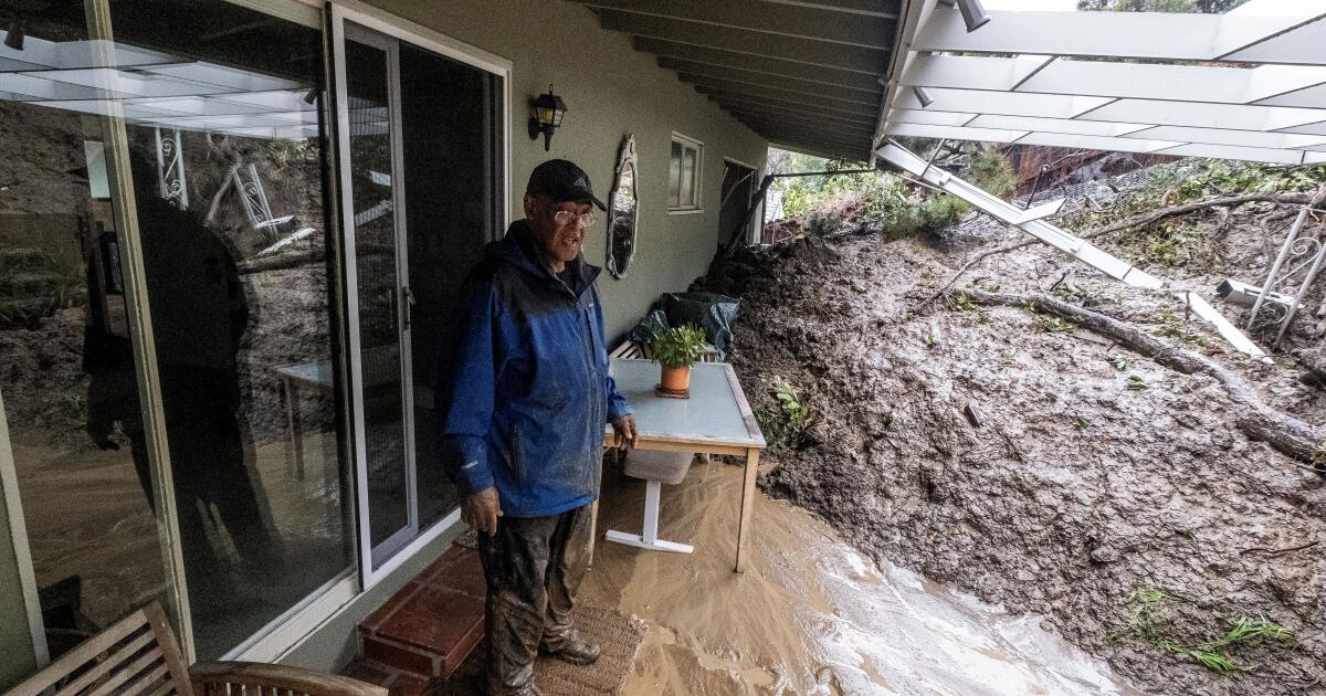
- Risks of flash floods and landslides (sudden floods and hillsides sliding).
- More high-tide flooding along the coast.
Let’s look at what happened before:
- In 3 of the 4 “very strong” El Niños on record, downtown Los Angeles got significantly more rain than average.
- In 1982-83 and 1997-98, downtown L.A. got more than double its usual yearly rainfall.
- But during the last “very strong” El Niño in 2015-16, downtown got only half its typical annual rainfall. So it’s not a sure thing!
- The last El Niño (2023-24) was “strong.” For the water year ending Sept. 30, 2024, downtown L.A. got 22.15 inches of rain (155% of its 14.25-inch average). That winter brought hundreds of landslides and the second-rainiest three-day period for downtown L.A. since records began in 1877.
- The state Department of Conservation said coastal Southern California got well-above average rain, and coastal Northern California slightly above normal. But interior areas like the Sierra Nevada and southeastern deserts got below normal.
- The state Coastal Commission said the 2015-16 “very strong” El Niño brought record coastal erosion along many California beaches.
- This year’s El Niño is expected to prolong an already existing marine heat wave (a patch of ocean warmer than usual for reasons not related to El Niño) off the Southern California coast.
Important: More rain can help drought, but it can also bring danger like landslides. Stay alert!
What About Warming Ocean Waters?
The planet’s oceans are heating up, and El Niño adds more heat. The World Meteorological Organization says an El Niño is “a source of heat for the atmosphere, increasing global temperature and shifting weather patterns.”
- On July 1, officials confirmed that the global sea surface temperature in June hit a record high for that time of year.
- Carlo Buontempo, director of the Copernicus Climate Change Service (part of the European Union), said: “Current conditions could indicate the beginning of a new phase… With ocean temperatures at these levels and El Niño on the horizon, we are likely to see more temperature records fall in the coming months.”
- Warming ocean waters can:
- Give storms extra energy (like a power-up).
- Increase evaporation, boosting chances of extreme rain and flooding.
- Contribute to sea level rise.
- Speed up ice melt.
- Stress marine ecosystems (hurt sea life).
Important: Hot oceans don’t just mean warmer swims; they change weather and harm sea creatures.
Summary
Let’s recap the big ideas:
- Experts are 97% sure a strong or very strong El Niño will form by December (81% chance of “super”).
- El Niño is a pattern of warm Pacific water and weak trade winds that feeds on itself.
- It can bring storms to Southern California, drought to other areas, and heat waves nearly everywhere.
- Southern California may see extra rain, landslides, and coastal flooding, but history shows it’s not guaranteed.
- Oceans are already record-hot, and El Niño will likely push global temperatures to new highs.
The Earth’s climate is like one big machine—when the Pacific warms, the whole world feels it!
FAQ
1. What is El Niño in the simplest words?
It’s a time when the tropical Pacific Ocean gets warmer than usual and the normal east-to-west winds weaken. This shifts weather patterns across the globe.
2. Will El Niño definitely bring huge rains and floods to California?
No. History shows L.A. sometimes got double its rain (like 1982-83), but in 2015-16 it got only half. It raises the odds, but it’s not a promise.
3. Why are scientists worried about warming oceans?
Hot oceans can supercharge storms, raise sea levels, melt ice, and break temperature records. El Niño adds extra heat on top of the warming humans caused.
4. How long does El Niño usually last?
Typically 9 to 12 months, and it takes time to reach full strength after it’s first declared.
5. What should Southern Californians do to get ready?
Learn about flood and landslide risks, especially if you live near hills or the coast. Watch local weather alerts when storms come.
 1
1