 11
11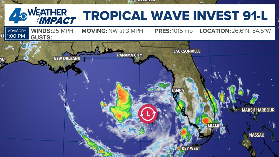
A tropical disturbance (that just means a messy cluster of storms and clouds) named Invest 91 L is spinning in the eastern Gulf of Mexico. This was true as of Saturday, July 18th.
The National Hurricane Center (NHC)—the official group that watches ocean storms—says there is now a 50% chance this system becomes a more organized tropical system over the next 7 days.
Important Point: The Gulf water is warm enough to help the storm get stronger, and the longer it sits over the water, the better its chance of growing.
It is called Invest 91 L because:
Right now, the storms tied to Invest 91 L are pretty messy and unorganized. But:
Here is where the weather gets bumpy:
For these areas, tropical moisture (wet air from the storm) moves in early in the work week.
Because Invest 91 L does not have a clear center, it is hard to say exactly where it will go.
Important Point: It does not look like it will become anything major, but it still needs watching. Lots of tropical moisture will likely sit over Gulf Coast states and bring heavy rain and some flooding.
Invest 91 L is a tropical disturbance in the Gulf with a 50% chance of development. It may bring heavy rain to Florida, Alabama, and Georgia, plus rough seas. Louisiana and Mississippi may see scattered storms midweek but low overall risk. The storm lacks a clear center, so its path is uncertain, but major intensity is not expected. An aircraft may investigate Sunday.
Q: What does "Invest" mean in Invest 91 L?
A: It means the system is being investigated by the National Hurricane Center using special computer models.
Q: Will Invest 91 L become a hurricane?
A: Right now, it does not look like it will intensify into anything major, though it could become a weak tropical depression.
Q: Should people in Louisiana worry?
A: Concern is low there because a high pressure system nearby helps reduce rain and storm growth.
Q: What are spaghetti models?
A: They are map lines that show possible storm paths, looking like a plate of squiggly noodles.
Q: How can I stay updated?
A: Watch for NHC updates and news, especially after the possible aircraft flight on Sunday.