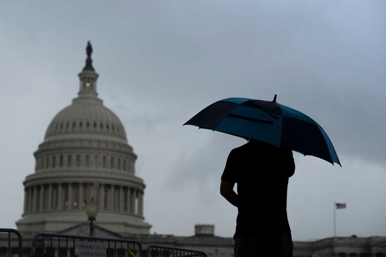
Wet Pattern Traps DC: Severe Storms, Flash Flooding Imminent
Stormy Weather Alert: What You Need to Know for the D.C. Area This Week
What’s Happening with the Weather?
Imagine a big, slow-moving rain cloud that decides to park itself right over Washington, D.C. for several days. That’s basically what’s happening! A slow-moving storm system is bringing multiple rounds of showers and thunderstorms to our region starting Sunday and lasting through at least the middle of the week.
Think of it like this: Instead of a quick rain shower that passes in an hour, we’re getting a "rainy vacation" where storms keep visiting day after day.
IMPORTANT ALERTS RIGHT NOW
[!WARNING]
Pay Attention to These Right Now:
- Ground Stop at BWI Marshall Airport until 1:15 p.m. (No planes taking off or landing)
- Ground Stop at Reagan National Airport until 1:45 p.m. (No planes taking off or landing)
- Severe storms possible Sunday afternoon – especially west of Interstate 95
- Flash flooding risk from heavy rainfall
- Damaging wind gusts are the main severe weather threat
Day-by-Day Forecast Breakdown
Sunday – WEATHER ALERT DAY
- What to expect: Showers and storms arriving in the afternoon/evening
- Temperatures: Highs between 82°F – 87°F (pretty warm!)
- Winds: South at 10-20 mph (breezy)
- Biggest concerns: Severe storms, damaging winds, flash flooding
Monday
- What to expect: Cloudy with areas of rain throughout the day
- Temperatures: High around 85°F
- Winds: South at 5-10 mph (lighter than Sunday)
Tuesday
- What to expect: Mostly cloudy with a chance of storms
- Temperatures: Highs between 83°F – 88°F
- Winds: Southeast at 5-10 mph
Wednesday
- What to expect: Partly cloudy with storm chances continuing
- Temperatures: Highs between 85°F – 90°F (warmest day!)
- Winds: South at 5-10 mph
What Makes This Storm System Special?
It’s SLOW. Most storms zip through in a few hours. This one is like a houseguest who overstays their welcome – it’s going to hang around for days, bringing wave after wave of rain.
Key Threats Explained Simply:
| Threat | What It Means | What to Do |
|---|---|---|
| Damaging Wind Gusts | Sudden strong winds that can break tree branches, knock down power lines, or blow around unsecured items | Secure outdoor furniture, stay indoors during storms |
| Flash Flooding | Very heavy rain in a short time that overwhelms drainage – roads and low areas flood QUICKLY | Never drive through flooded roads ("Turn Around, Don’t Drown!") |
| Severe Thunderstorms | Storms with hail, very strong winds, or even brief tornadoes | Have a way to get warnings (phone alerts, weather radio) |
Your Action Plan: 5 Steps to Stay Safe
- Check your alerts – Make sure weather notifications are ON for your phone
- Secure outdoor items – Patio furniture, trash cans, decorations – bring them in or tie them down
- Plan indoor activities – Have backup plans for Sunday through Wednesday
- Know your flood risk – If you live near a stream, creek, or low-lying area, be extra alert
- Check travel plans – Flight delays/cancellations likely; allow extra time for driving
Quick Summary
TL;DR (Too Long; Didn’t Read):
- Sunday is the biggest concern – severe storms, damaging winds, flash flooding possible
- Airports have ground stops until early afternoon – check your flight status!
- Rain continues daily through at least Wednesday – keep umbrella handy all week
- Main dangers: Strong wind gusts and sudden flooding from heavy downpours
- Stay informed – weather can change quickly with slow-moving systems like this
Frequently Asked Questions
Q: Should I cancel my outdoor plans for Sunday?
A: Yes, it’s smart to have indoor backup plans. Storms are most likely in the afternoon/evening, but timing can shift. Morning might be okay, but stay flexible!
Q: What does "ground stop" at the airports mean for my flight?
A: It means NO planes can take off or land right now. Even after it lifts, expect delays. Check with your airline before heading to the airport.
Q: How much rain are we talking about?
A: The National Weather Service hasn’t given exact totals yet, but "localized heavy rainfall" means some spots could get 1-3+ inches in a short time – enough for flash flooding.
Q: Is it safe to drive during these storms?
A: If you MUST drive: slow down, increase following distance, NEVER drive through standing water (even 6 inches can float a car!), and pull over if visibility gets too bad.
Q: Will this ruin the whole week?
A: Not necessarily "ruin" – but expect daily rain chances through at least Wednesday. Some hours will be dry, some wet. It’s a "keep your umbrella handy" kind of week, not a "stay locked inside" week.
Stay Connected & Informed
Get breaking weather alerts delivered to your email: Sign up for WTOP newsletters
Follow official sources:
- National Weather Service Baltimore/Washington: @NWS_BaltWash
- 7News First Alert Meteorologist Mark Peña for local updates
Remember: Weather forecasts can change! Check for updates throughout the day, especially Sunday. Stay safe out there!
© 2026 WTOP. All Rights Reserved. This website is not intended for users located within the European Economic Area.