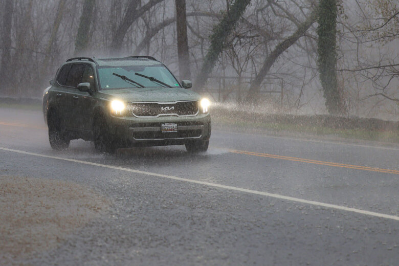
DC Monday Forecast: Life-Threatening Flash Floods Possible
Stormy Week Ahead: What D.C. Residents Need to Know About Flooding, Heat, and Daily Thunderstorms
The Big Picture: A Wet and Unsettled Week
Imagine the atmosphere like a giant, wet sponge that keeps getting squeezed out over the D.C. area. Monday kicks off a stretch of daily storm chances that could last right through the weekend. While it won’t rain all day, every day, you’ll want to keep an umbrella handy and stay weather-aware.
IMPORTANT ALERT
D.C. Mayor Muriel Bowser has issued a Heat Alert until 8 p.m. Monday. With temperatures in the 80s feeling like the 90s (thanks to humidity), heat-related illnesses are a real risk. Stay hydrated, check on neighbors, and limit outdoor exertion.
Monday’s Threats: What to Watch For
Meteorologist Jordan Evans (7News First Alert) and Kevin Rodriguez (National Weather Service) break down the specific risks for Monday:
Main Hazards
- Flash Flooding – Heavy downpours can overwhelm drains and low-lying areas fast
- Gusty Winds – Strong enough to snap tree limbs and knock out power
- Lightning – Standard with any thunderstorm, but dangerous if you’re outside
- Heat + Humidity – Mid-to-upper 80s with heat index in the 90s
Where Storms Are Most Likely
- South of I-66 – Higher storm coverage expected here
- Urban areas & poor drainage zones – Flash flood risk highest
- Western D.C. suburbs – Got 2–3.5 inches of rain Sunday (life-threatening flooding occurred)
REAL-WORLD EXAMPLE
Sunday in Montgomery County: A large tree limb fell, pulling down wires and damaging a utility pole. Another downed tree blocked Clara Barton Parkway. This is what gusty winds + saturated ground can do.
Day-by-Day Forecast Breakdown
| Day | Conditions | High / Feels Like | Key Details |
|---|---|---|---|
| Monday Evening | Cloudy → clearing, showers end | 72–81°F | West winds 5–10 mph |
| Monday Night | Partly cloudy, humidity drops | Lows 63–74°F | Refreshing 60s by morning! |
| Tuesday | Morning sun → afternoon clouds | 84–88°F / mid-80s | NE winds 5–10 mph, less humid |
| Wednesday | Partly cloudy, scattered storms | 83–88°F | SE winds 5–10 mph, wetter day |
| Thursday | Partly cloudy, isolated PM storms (30%) | 89–93°F / feels like 102°F | SW winds 5–10 mph, stalled system moving out |
| Friday | Partly cloudy, storms likely (60%) | 88–93°F / feels like 102°F | Pop-up storms with heavy rain, lightning, gusty winds |
| Weekend | Daily afternoon storm chances continue | Upper 80s–low 90s | Not all-day rain, but keep plans flexible |
Why This Pattern? (ELI5 Explanation)
Think of a stalled weather maker (a low-pressure system) parked nearby. It acts like a conveyor belt, pulling warm, moist air up from the south.
- Daytime heating = atmosphere gets "unstable" (like shaking a soda bottle)
- Result = Afternoon/evening pop-up storms
- This weekend = The system may drift offshore, but that could actually increase severe storm risk Thursday/Friday
How to Stay Safe: Your Action Checklist
Before Storms Hit
- Charge devices – Power outages are likely
- Secure outdoor items – Patio furniture, trash cans, decorations
- Check drainage – Clear gutters, storm drains near your home
- Download alerts – NWS app, 7News weather alerts, or Wireless Emergency Alerts (WEA)
During a Storm
- If driving: TURN AROUND, DON’T DROWN – 6 inches of moving water knocks you down; 1 foot floats a car
- Avoid flooded roads – Especially at night when depth is hard to see
- Stay indoors – Away from windows during high winds/lightning
- Report outages – Pepco (DC/MD): 1-877-737-2662 | Dominion (VA): 1-866-366-4357
After the Storm
- Stay away from downed wires – Assume all are live
- Check on vulnerable neighbors – Elderly, those with medical equipment
- Document damage – Photos for insurance
- Boil water if advised – Flooding can contaminate systems
Summary: Key Takeaways
- Daily storm chances through at least Friday, peaking Wed–Fri
- Flash flooding is the #1 threat – especially in urban/poor-drainage areas
- Heat + humidity = dangerous "feels-like" temps 100°F+ Thu/Fri
- Power outages likely – Prep now (flashlights, batteries, charged phones)
- Not all-day rain – Most storms hit afternoon/evening; mornings often nicer
- Pattern may shift – Weekend forecast still evolving; check daily
Frequently Asked Questions
1. Will it rain all day every day this week?
No! Most days feature morning sunshine with storms bubbling up in the afternoon/evening (typical summer pattern). Wednesday looks wettest; Tuesday may be the "nicest" day.
2. What’s the difference between a "watch" and a "warning"?
- Watch = Conditions favorable for dangerous weather (be ready)
- Warning = Dangerous weather is occurring or imminent (take action NOW)
- Flash Flood Warning = Move to higher ground immediately!
3. How much rain causes flash flooding?
In urban areas with lots of pavement, just 1–2 inches in an hour can overwhelm storm drains. Sunday’s 2–3.5 inches in the western suburbs caused life-threatening flooding.
4. Why does the "feels like" temperature matter?
Your body cools by sweating. High humidity blocks evaporation, so your body can’t cool down. At 93°F feeling like 102°F, heat exhaustion/stroke risk rises sharply – especially for kids, seniors, and outdoor workers.
5. Should I cancel outdoor plans for the weekend?
Don’t cancel – have a Plan B. Morning/early afternoon often stays dry. Have indoor backup options, monitor radar, and be ready to seek shelter if storms develop.
STAY CONNECTED
Get breaking weather alerts delivered straight to your inbox: Sign up for WTOP newsletters
Source: 7News First Alert Meteorologist Jordan Evans, National Weather Service Baltimore/Washington (Kevin Rodriguez), D.C. Mayor’s Office. Forecast data current as of Monday morning.