Gann Fire Rages: Calaveras Evacuations Ordered, Live Maps & Updates
The Gann Fire: What’s Happening in Calaveras County (Explained Simply)
What Is the Gann Fire?
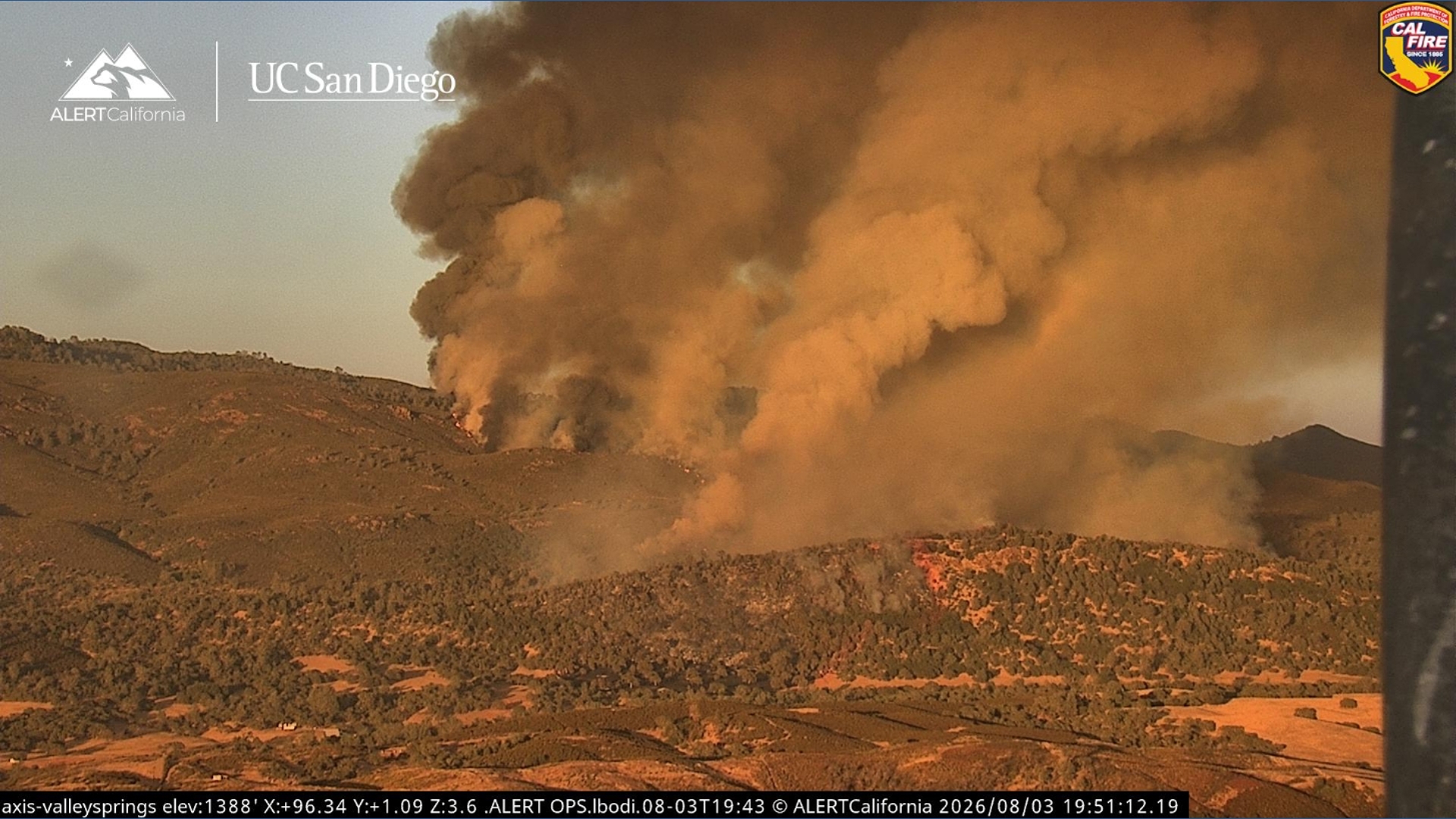
Quick Summary: A wildfire named the Gann Fire started on Monday evening in Calaveras County, California. It has burned about 310 acres so far (that’s roughly 235 football fields!) and is currently 0% contained. Firefighters are working hard to stop it from spreading.
Where Did It Start?
The fire began near Hogan Dam Road and Gann Road in the community of Valley Springs.
- Location: Valley Springs, Calaveras County, California
- Time Started: Around 5:30 p.m. on Monday evening
- Current Size: ~310 acres
- Containment: 0% (this means firefighters haven’t yet built a control line around the fire)
Is the Fire Moving Toward Homes?
Good news: According to Calaveras Consolidated Fire, the fire is burning AWAY from Valley Springs.
However, the fire has a moderate to dangerous rate of spread, which means it could move quickly if conditions change (like if the wind picks up).
What Are Firefighters Doing?
Crews are actively working to slow the spread of the fire. This includes:
- Fire engines on the ground
- Helicopters and air tankers dropping water and fire retardant from above
- Firefighters building containment lines (cleared paths that stop the fire from moving forward)
Important: How to Stay Informed & Safe
IMPORTANT: SIGN UP FOR EMERGENCY ALERTS
Nixle is a free service that sends text messages about emergencies in YOUR area — including wildfires, severe weather, and evacuation orders.
Two easy ways to sign up:
- Visit: www.nixle.com
- Text your ZIP code to 888777 (for example:
95252to 888777)It takes 30 seconds and could save your life.
Maps You Should Check
| Map | What It Shows | Why It Matters |
|---|---|---|
| Evacuation Map | Which areas are under evacuation orders, warnings, or are safe | Tells you if you need to leave NOW |
| Perimeter Map | The current edge of the fire | Helps you see how close the fire is to your home |
Check both maps often — fire conditions change fast!
Step-by-Step: What Should YOU Do Right Now?
- Check the evacuation map — Are you in an evacuation zone?
- Sign up for Nixle alerts — Get real-time texts for your ZIP code
- Pack a "go bag" — Medications, important documents, phone charger, clothes, pet supplies
- Know two ways out — Plan evacuation routes from your home
- Stay calm & stay informed — Follow official sources only (Cal Fire, Sheriff’s Office, Nixle)
Summary
- The Gann Fire started Monday at ~5:30 p.m. near Hogan Dam Road & Gann Road in Valley Springs
- It has burned ~310 acres and is 0% contained
- The fire is moving away from Valley Springs but has a moderate to dangerous spread rate
- Firefighters are actively battling the fire on ground and from air
- Sign up for Nixle alerts (text ZIP to 888777) for real-time updates
- Check evacuation & perimeter maps regularly
Frequently Asked Questions (FAQ)
What does "0% contained" mean?
It means firefighters haven’t yet established a complete control line around the fire. The fire could still grow. It does not mean nothing is being done — crews are actively working!
How big is 310 acres?
Think of 235 football fields put together. That’s a lot of land, but in wildfire terms, it’s considered a medium-sized fire so far.
Should I evacuate now?
Only if you’re in an evacuation ORDER zone. Check the official evacuation map. If you’re in a WARNING zone, get ready to leave. If you feel unsafe, leave early — don’t wait!
What if I don’t have a smartphone?
You can still sign up for Nixle by texting your ZIP code to 888777 from any cell phone (even a flip phone). You can also call the Calaveras County Sheriff’s Office non-emergency line for updates.
Where do I find the evacuation and perimeter maps?
The original article mentions they’re "available below" — check the Cal Fire website, Calaveras County Sheriff’s Office Facebook page, or local news stations for the latest maps.
Stay Safe, Stay Informed
Wildfires move fast. Your best protection is early information and early action. Sign up for alerts, check the maps, and have a plan.