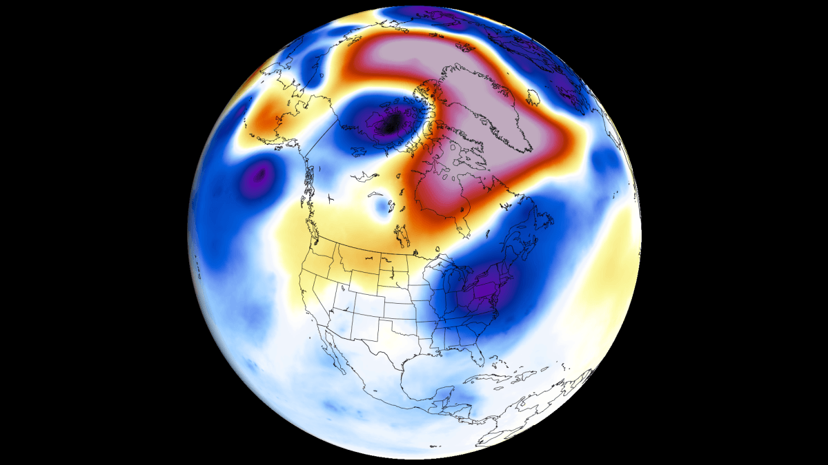
Super El Niño Ignites August Shift: Fall & Winter Signals Strengthen
Super El Niño 2026/2027: What It Means for Your Weather — A Simple Guide
ELI5 Alert: This article explains a complex weather event in plain language. Think of the Pacific Ocean like a giant bathtub — when the water gets extra hot in certain spots, it changes weather all around the world.
What Is a "Super El Niño" Anyway?
Imagine the tropical Pacific Ocean as a massive swimming pool. Normally, trade winds blow warm water toward Asia, keeping the eastern Pacific (near South America) cooler. But every few years, those winds weaken or reverse, letting warm water slosh back toward the Americas. That’s El Niño.
A Super El Niño is like El Niño on steroids — the water gets much hotter than usual (over +2°C above normal, possibly +3°C or more). This one is developing unusually fast and could rival the strongest events in recorded history.
KEY POINT: The ocean doesn’t just sit there — it talks to the atmosphere. Hot water heats the air above it, creating rising motion that sets off a chain reaction around the globe. Scientists call this the "atmospheric bridge."
How Do We Know It’s Coming? (The Evidence)
Scientists use satellites, buoys, and supercomputer models to track this. Here’s what they’re seeing:
1. Ocean Temperatures Are Off the Charts
- Main ENSO regions (key monitoring zones in the Pacific) already show +5°C anomalies in spots.
- That’s 5 degrees Celsius above normal — huge for the ocean.
- The warm pool is spreading westward and eastward faster than past Super El Niños.
2. A Giant Underwater Wave Is Rising
- Kelvin Wave: A massive pulse of warm water moving eastward under the surface.
- Think of it like a hidden tsunami of heat. It’s now breaking the surface, fueling the El Niño.
- Westerly wind bursts (short periods of west-to-east winds) helped push it along.
3. Forecast Models Agree: "Extreme" Territory
| Model | Prediction | Confidence |
|---|---|---|
| NOAA CFSv2 | +3°C anomaly (beyond "Super" threshold) | High |
| NOAA CPC (official) | "Very strong" to "extreme" category peak in late fall/winter | High (ensemble agreement) |
| NMME (multi-model) | Eastern Pacific (EP) type event, peak > +4°C | High |
IMPORTANT: This isn’t a maybe. Multiple independent systems see the same thing. The atmosphere is already responding (see July patterns below).
July 2026: The Atmosphere Already Got the Memo
Weather patterns in July matched past Super El Niño Julys almost perfectly. That’s the "fingerprint" of the event showing up early.
North America (Close to the Action)
- Low pressure anchored over the western/central U.S. → pulled warm air north.
- Result: Cool West Coast, very warm central/eastern U.S. & Canada.
- Real-time temps matched the textbook pattern (see analysis maps in source).
Europe (Farther Away, More Complicated)
- Blocking high over northern Europe → heat in west, milder in east/northeast.
- July temps matched this too: Western Europe hot, eastern Europe near/below normal.
The "Smoking Gun": Rising & Sinking Air
- Velocity Potential maps (showing where air rises/sinks at ~12 km up) reveal:
- Strong rising air (teal) over central/eastern Pacific → El Niño engine running.
- Strong sinking air (brown) over Indian Ocean → the other end of the Walker Cell.
- This modified Walker Cell is the atmospheric bridge in action — global circulation is already rewired.
August Forecast: The Pattern Shifts
As the El Niño grows, it locks in a "standing wave" — a nearly stationary area of rising air over the tropical Pacific. This forces the jet stream to change shape.
United States & Canada: A Tale of Two Halves
| Period | Pattern | Temperature | Rainfall |
|---|---|---|---|
| Early Aug | Ridge (high pressure) over west-central U.S./Canada; low over east | West/Central U.S. warm; East near/below normal; E. Canada warm, W. Canada cool | Wet: NE U.S., SE Canada Dry: N. & S-central U.S., S. Canada |
| Mid-Late Aug | Low shifts to eastern U.S./Canada; ridge holds west | East/U.S./SE Canada cool; Warmth persists S-central U.S., S. Canada | Wet: W. & NE U.S., SE Canada Dry: S-central U.S., Upper Midwest, PNW, FL |
SCIENCE BIT: The subtropical jet stream (southern branch of the fast wind river) starts getting amplified by a deepening Pacific low. This is the preview of the winter storm track.
Europe: Resisting at First, Then Adjusting
- Early Aug: Low pressure north, high central/south → hot & dry most of continent; cool/wet northwest.
- Mid-Late Aug: High shifts east; low drops south into W. Europe → heat dome moves east, west/central Europe cools to near normal.
- Why the lag? Europe is far from the Pacific "engine." Other factors (Atlantic temps, soil moisture) interfere until fall/winter when El Niño’s signal overwhelms them.
Why This El Niño Is Different: The Mechanics
Not all El Niños are alike. Two big factors change the weather outcome:
1. Where the Heat Peaks Matters
- Central Pacific (CP) El Niño: Heat centered near Dateline → stronger, more direct hit on jet stream → bigger North American winter impact.
- Eastern Pacific (EP) El Niño: Heat centered near South America → weaker initial ripple (explains Europe’s slow start).
- This one? EP type — but so extreme (+4°C+) that raw power overcomes location.
2. Strength Amplifies Everything
- Moderate El Niño: Gentle wave in jet stream.
- Extreme El Niño: Deep Pacific trough + strong Canadian ridge = "atmospheric highway".
- Mild air locked in Canada/Arctic.
- Active storm track blasted across southern U.S..
- Fall 2026 already looks like a moderate El Niño winter pattern — it’s running ahead of schedule.
Fall 2026 Forecast: Winter Arrives Early
The models show a classic, amplified El Niño autumn pattern:
North America
- Temperatures: Warm north (N. U.S., Canada) under Canadian ridge; Near normal south (storm track keeps it cooler).
- Precipitation: Wet across most of U.S. (especially South) — amplified Pacific jet brings moisture & storms. Dry: NW U.S., Upper Midwest, parts of Canada.
Europe
- Temperatures: Warmer than normal continent-wide, peak in W./Central Europe.
- Precipitation: Wetter than normal (except far north) — westerly flow from Atlantic low brings moisture.
KEY TAKEAWAY: The pattern is evolving faster and stronger than typical because the ocean forcing is so intense.
Winter 2026/2027: The "Split-Flow" Pattern
This is the headline for winter. The jet stream splits into two branches:
    POLAR JET (weakened, far north)
          │
          ▼
┌───────────────────┐
│  STRONG HIGH      │  ← Blocks Arctic air
│  OVER CANADA      │
└───────────────────┘
          │
          ▼
┌───────────────────┐
│  SUBTROPICAL JET  │  ← Supercharged, runs across
│  (STORM TRACK)    │     SOUTHERN U.S.
└───────────────────┘
What This Means for You
| Region | Temperature | Precipitation / Snow | Why? |
|---|---|---|---|
| Canada / N. Plains / Upper Midwest / Great Lakes | Much warmer | Less snow | Canadian ridge blocks cold; storm track too far south |
| Central/Southern Plains, Interior Mid-Atlantic | Colder (esp. Jan-Feb) | More storms, snow/ice chances | Right under the supercharged subtropical jet |
| Gulf Coast / Deep South | Colder | Wet, stormy | Frequent low-pressure systems |
| Europe | Milder (westerly flow) | Wetter (Atlantic storms) | Downstream effect of Pacific pattern |
The Evolution: January → February
- January: Cool anomaly establishes in Southern Plains/Gulf Coast; Canada very warm.
- February: Cool anomaly deepens & expands → broad below-normal temps across Central, Southern, Eastern U.S. Cold air intrusions become frequent.
IMPORTANT POINTS TO REMEMBER
- This is a record-pace Super El Niño — not a normal one. Impacts are amplified and arrive early.
- The atmosphere is already coupled — July patterns proved it. Fall/winter will only strengthen.
- Split-flow winter pattern = Mild North, Stormy/Cool South in U.S. Canada stays warm; Europe mild/wet.
- Snow lovers in the North: bad news. South/Central U.S.: watch for winter storms.
- Forecasts update weekly. Bookmark reliable sources (NOAA, ECMWF, Severe Weather Europe).
Summary: The Big Picture in 5 Steps
- Pacific Ocean overheats → Super El Niño forms fast (Kelvin wave + wind bursts).
- Atmosphere responds → Walker Cell flips, rising air locks over Pacific (standing wave).
- Summer patterns match history → July temps/pressure = textbook Super El Niño.
- Fall accelerates → Pacific jet amplifies, Canadian ridge builds, storm track shifts south early.
- Winter goes split-flow → Two jet streams: polar jet north (weak), subtropical jet south (strong) → Warm North, Cool/Stormy South.
FAQ: Your Questions Answered
Is this climate change?
Not directly. El Niño is a natural cycle (ENSO). But climate change warms the background ocean, so when El Niño happens, it starts from a higher baseline → easier to reach "Super" levels. Think of it as a fever on top of a warmer body.
Will my city get a big snowstorm?
Depends where you are.
- Northern tier (Seattle → Chicago → Boston): Unlikely. Storm track too far south.
- Central/Southern Plains (Dallas → St. Louis → DC): Higher chance. You’re under the main storm highway.
- Details matter. Exact storm tracks shift week to week. Watch short-range forecasts in winter.
Why does Europe lag behind?
Distance + noise. The Pacific signal takes time to propagate across North America, the Atlantic, then hit Europe. Summer has other drivers (Atlantic temps, land heating). By winter, the Pacific signal dominates → Europe feels it clearly (mild/wet).
Could the forecast be wrong?
Always possible. Models struggle with:
- Exact peak intensity (+3°C vs +4°C changes impacts).
- Sub-seasonal variability (e.g., sudden stratospheric warming can disrupt the pattern for weeks).
- But: The broad brush (Super El Niño → split flow → mild N / stormy S) is high confidence because the ocean forcing is so extreme.
When will we know for sure?
- Monthly updates from NOAA (CPC) & ECMWF.
- Critical period: October–December — when the winter pattern locks in.
- Weekly model runs (ECMWF, GFS, CFSv2) give shorter-term clues. Check back in 10 days for the next major update.
Stay Informed: Weather patterns evolve. This forecast is based on late July/early August 2026 data. For the latest, follow NOAA CPC, ECMWF, and Severe Weather Europe. The atmosphere writes its own story — we’re just reading the early chapters.