The Aspen Acres Fire: What Happened and What You Need to Know
Imagine a giant campfire that got way out of control. That’s basically what the Aspen Acres Fire is — a huge wildfire in southern Colorado that has become one of the biggest in the state’s history. Let’s break it down in a super simple way.
What Is the Aspen Acres Fire?
The Aspen Acres Fire is a very large wildfire (a fire that burns in forests or wild areas) in southern Colorado, near a town called Rye.
- It has burned almost 100,000 acres of land. (An acre is about the size of a football field — so that’s like 100,000 football fields!)
- Fire officials say 851 structures (buildings like houses, barns, or sheds) have been destroyed.
- At least 337 of those destroyed structures are homes where people lived.
- The fire started on June 29.
- It is the 7th-largest wildfire ever recorded in Colorado.
- Officials announced on July 2 that the fire was caused by humans (not by lightning or nature), but they are still investigating exactly how.
- As of Thursday evening, the fire had burned 99,820 acres and was 48% contained.
- “Contained” means firefighters have built barriers or stopped the fire from spreading in that portion of the area.
Important Point: The Aspen Acres Fire is among the largest in Colorado history and has destroyed 851 structures, including at least 337 homes. It is human-caused and still being investigated.
No Drones Allowed!
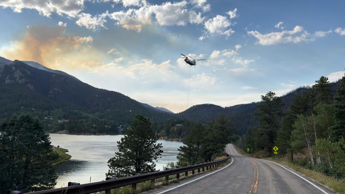
Because planes and helicopters help fight the fire, there is a Temporary Flight Restriction (TFR) over the fire area.
- A TFR is like a “no-fly zone” — it means you cannot fly any aircraft there.
- This includes drones (small flying cameras) or any unmanned aerial systems (machines that fly without a pilot).
- Flying them there can be dangerous and illegal.
Evacuations and Road Closures
When a fire gets close, people may need to leave their homes for safety. Here’s what’s happening in different counties:
Pueblo County
- People in Beulah started going back home on Monday.
- The north and northeast parts of the fire area are no longer under evacuation — people south of Highway 96 and north of Highway 78 can return.
- But everyone must stay in pre-evacuation status (be ready to leave quickly if things change).
- The fire is still active near North Muddy Creek and might move toward Rye, so the south side is still evacuated.
- Colorado City is in pre-evacuation status.
- Call the Joint Information Center (JIC) at 719-583-4640 for help or Disaster Assistance Center info.
- More info: Pueblo County Sheriff’s Office website.
Fremont County
- The Sheriff removed the pre-evacuation status.
- An “Awareness Status” is in place: residents should stay informed and prepared.
- Updates on Facebook: Fremont County Sheriff’s Office page.
Custer County
- Wetmore residents began returning on Monday but are in pre-evacuation status.
- Other parts of the county are still evacuated.
- Highway 96 is open from Siloam Road to County Road 395, but closed from CR 395 to Mackenzie Junction.
- Highway 67 from Wetmore to Florence is open.
- Call 719-467-0271 for re-entry questions.
Huerfano County
- The Sheriff evacuated specific forest areas bounded by creeks and county roads (basically the National Forest east of Williams Creek up to the county line).
- Call 719-738-1044 for Huerfano County dispatch info.
Road Closures
- For the latest road closures, visit cotrip.org.
Important Point: Even if you can go home, you may still need to be ready to leave at any moment. Always follow your local sheriff’s updates.
Summary
The Aspen Acres Fire in southern Colorado is a massive, human-caused wildfire that has burned nearly 100,000 acres and destroyed 851 structures (337+ homes). It is 48% contained. No drones or aircraft may fly over the area. Some residents in Pueblo, Fremont, Custer, and Huerfano counties have been allowed to return, but many remain under evacuation or pre-evacuation status. Roads are partially closed, and official websites or phone numbers should be used for the latest info.
FAQ
1. What does “48% contained” mean?
It means firefighters have stopped the fire from spreading in 48% of the total fire area. The rest is still burning or not yet secured.
2. Why can’t I fly my drone near the fire?
A Temporary Flight Restriction is in place so firefighting planes and helicopters can work safely. Drones can crash into them or get in the way.
3. Is the fire still dangerous if I’m allowed to go home?
Yes. If you are in pre-evacuation status, you must be packed and ready to leave in case the fire moves closer.
4. How do I know if my area is evacuated?
Check your county sheriff’s website or call the numbers listed above (e.g., Pueblo: 719-583-4640, Custer: 719-467-0271).
5. What caused the Aspen Acres Fire?
Officials say it was human-caused, but they are still investigating the exact source.
 1
1