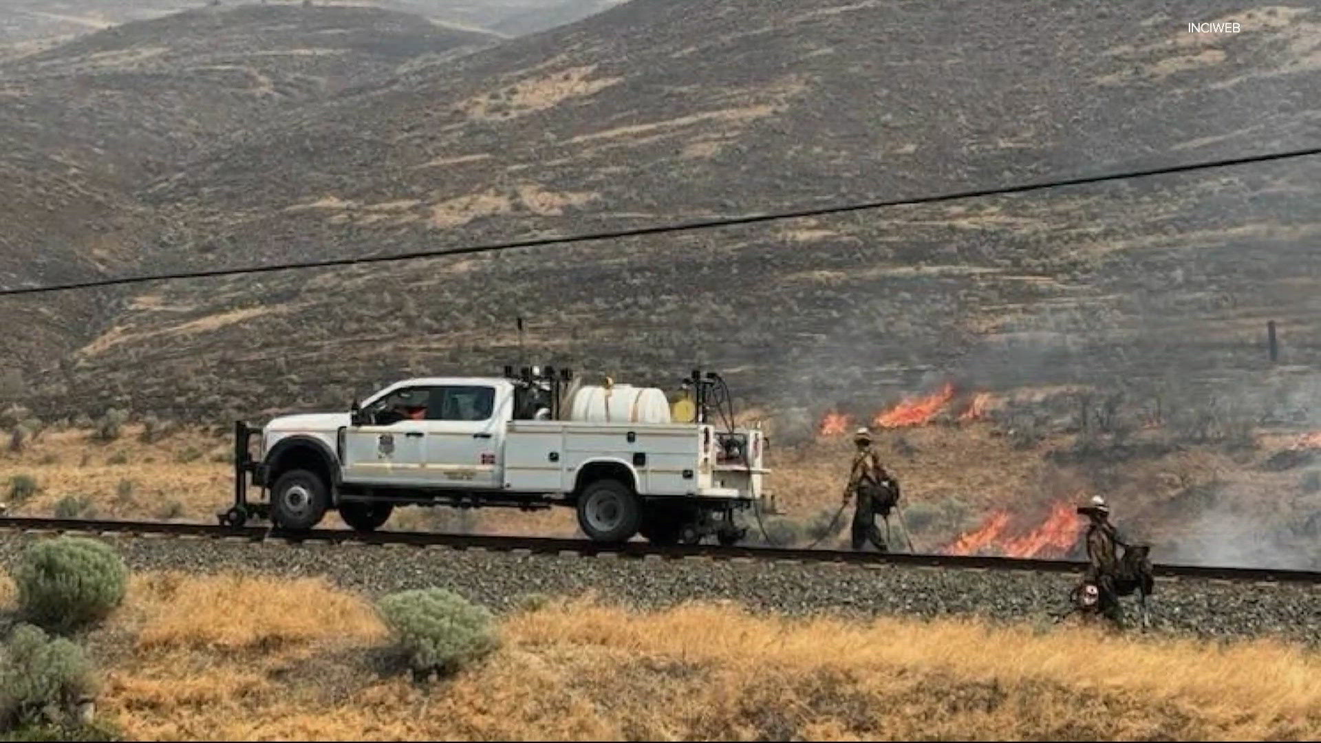
Oregon’s 2026 Wildfire Season Breaks Records: What You Need to Know
Important Alert
This is a developing situation. All information below is current as of 8:00 p.m. Saturday, August 1, 2026. Conditions can change rapidly. Always check official sources for the latest updates.
The Big Picture: A Record-Breaking Season
Oregon’s 2026 wildfire season has officially become the largest on record. Here’s what that means in simple terms:
- Total acres burned: 1,991,419 acres (that’s over 3,100 square miles — bigger than the state of Delaware!)
- Previous record: 1.93 million acres in 2024
- What pushed us over: A Red Flag Warning (extreme fire danger conditions) covered most of northeast Oregon and eastern Washington over the weekend
- Main cause: Dozens of fires sparked by lightning strikes between July 15–18
ELI5: Imagine a lightning storm hitting very dry forests. The lightning acts like matches, and the dry weather acts like gasoline. That’s what happened in mid-July.
Major Fires by County
Fires are organized by where they started. Some cross county lines. All containment percentages are approximate.
Wheeler County
Rowe Creek Complex
This "complex" means several fires merged into one big fire.
| Detail |
Information |
| Location |
Near Fossil, along the John Day River (spans Wheeler, Wasco & Crook counties) |
| Size |
313,439 acres (largest single fire) |
| Cause |
Lightning |
| Started |
July 15 |
| Containment |
57% |
| Closures |
BLM land along John Day River; Clarno & Painted Hills sections of John Day Fossil Beds National Monument |
| Evacuations |
Level 3 (GO NOW), Level 2 (BE SET), Level 1 (BE READY) — Interactive map here |
| Info Sources |
Wheeler County Sheriff • Genasys Protect |
Sub-fires in this complex:
- Crosswhite East: 181,443 acres
- Camel Hump: 6,614 acres
- Parrish: 404 acres
- Deep Canyon: 8,089 acres
Gilliam, Sherman & Wasco Counties
Hay Creek Complex
Multiple fires managed together.
| Detail |
Information |
| Total Size |
200,292 acres |
| Cause |
Multiple (lightning suspected) |
| Started |
July 15 |
| Containment |
98% (mostly contained!) |
| Key Fires in Complex: |
| • Hoag Fire (merged with Starvation Point & Lower Rock Creek) |
50,224 acres • 99% contained |
| • Porcupine Ridge Fire (merged with McInnes, 456 & Wilcox) |
80,081 acres • 99% contained |
| • Hopkin Fire |
11,366 acres • 99% contained |
| • Cottonwood Fire (new July 23) |
0% contained |
| • Little Buck Fire (new July 23) |
0% contained |
| Closures |
BLM land near I-84/Hwy 97 junction, Hwy 26, Hwys 27 & 20 |
| Evacuations |
Some along Scott Canyon Lane • Shelter at South Gilliam Emergency Services (Condon) |
| Info Sources |
Gilliam County Sheriff • Hay Creek Complex 2026 Facebook |
Malheur County
1. Cow Valley Fire
| Detail |
Information |
| Location |
25 miles SW of Jordan Valley |
| Size |
307,518 acres |
| Cause |
Lightning |
| Started |
July 25 |
| Containment |
21% |
| Closures |
Large area south of Trout Creek Rd & Silver City Rd to Owyhee River |
| Evacuations |
LEVEL 3 (GO): Pleasant Valley, South Mountain, Jordan Valley (ID), Flint Creek Rd, Triangle Area, West Mud Flat, Juniper Mountain • LEVEL 2 (SET): Silver City |
| Info |
Owyhee County Sheriff |
2. Juntura Fire
| Detail |
Information |
| Location |
Near Juntura (Malheur & Harney counties) |
| Size |
212,182 acres |
| Cause |
Lightning |
| Started |
July 25 |
| Containment |
0% |
| Evacuations |
LEVEL 3: Juntura, OR • LEVEL 2 & 1: Nearby Harney County areas |
3. Soldier Fire
| Detail |
Information |
| Location |
40 miles east of Burns |
| Size |
44,122 acres |
| Cause |
Lightning |
| Started |
July 24 |
| Containment |
93% (almost contained!) |
| Evacuations |
None |
Grant County
Salmon Fire
| Detail |
Information |
| Location |
SW of Granite, North Fork John Day Wilderness |
| Size |
1,426 acres |
| Cause |
Lightning |
| Started |
July 8 |
| Containment |
72% |
| Closures |
Malheur, Umatilla & Wallowa-Whitman National Forests |
| Evacuations |
Level 3, 2 & 1 around Salmon & Olive Butte fires |
| Community Meeting |
Thursday 6 p.m. at Prairie City High School (also on Facebook) |
Olive Butte Fire
| Detail |
Information |
| Location |
Same area as Salmon Fire |
| Size |
3,086 acres |
| Cause |
Lightning |
| Started |
July 8 |
| Containment |
64% |
| Evacuations |
Level 3, 2 & 1 |
Harney County
1. Riley Fire
| Detail |
Information |
| Location |
6 miles north of Riley |
| Size |
103,459 acres |
| Cause |
Undetermined |
| Started |
July 24 |
| Containment |
18% |
| Evacuations |
None |
2. Warm Springs Fire
| Detail |
Information |
| Location |
12 miles north of Riley |
| Size |
4,595 acres |
| Cause |
Lightning |
| Started |
July 16 |
| Containment |
68% |
| Evacuations |
None |
Baker County
1. Durkee Fire
| Detail |
Information |
| Location |
5 miles west of Richland |
| Size |
21,088 acres |
| Cause |
Undetermined |
| Started |
July 16 |
| Containment |
96% |
| Closures |
BLM land near fire |
| Evacuations |
Level 3 & 2 — RAPTOR Map |
| Info |
Baker County Sheriff |
2. Cain Fire
| Detail |
Information |
| Location |
12 miles NE of Huntington |
| Size |
75,841 acres |
| Cause |
Undetermined |
| Started |
July 23 |
| Containment |
46% |
| Closures |
BLM land near fire |
| Evacuations |
Level 3 & 2 — RAPTOR Map |
Jefferson County
1. Akawa Butte Fire Nation’s #1 Priority
2. Beachcomb Fire
| Detail |
Information |
| Location |
4 miles SW of Warm Springs Reservation |
| Size |
66,760 acres |
| Cause |
Unknown |
| Started |
July 23 |
| Containment |
52% |
| Road Closure |
US-26 closed (milepost 108–110) |
| Evacuations |
Level 3, 2 & 1 — Interactive Map |
| Shelters |
Old School Cafeteria (1150 Warm Springs St) • St. Patrick’s Church (341 SW J St, Madras) |
| Livestock |
Jefferson County Fairgrounds (430 SW Fairgrounds Rd) |
3. Bench Fire
| Detail |
Information |
| Location |
4 miles SW of Warm Springs Reservation |
| Size |
13,648 acres |
| Cause |
Unknown |
| Started |
July 23 |
| Containment |
0% |
| Key Update |
Merged with Beachcomb Fire — extreme fire behavior, heavy aircraft deployed |
| Road Closure |
US-26 closed (milepost 108–110) |
| Evacuations |
Level 3, 2 & 1 |
| Shelters |
Same as Beachcomb Fire |
4. Brewer Fire
| Detail |
Information |
| Location |
1 mile east of Brewer Reservoir (Crook & Jefferson counties) |
| Size |
70,821 acres |
| Cause |
Lightning |
| Started |
July 15 |
| Containment |
10% |
| Evacuations |
Level 3, 2 & 1 for Brewer & Box Springs fires |
| Info |
Crook County Sheriff • Jefferson County Sheriff |
Umatilla County
Bingham Fire
| Detail |
Information |
| Location |
South of Bingham Road |
| Size |
37,035 acres |
| Cause |
Lightning |
| Started |
July 16 |
| Containment |
8% |
| Evacuations |
Level 3, 2 & 1 — Interactive Map |
| ALERT |
PDS Red Flag Warning (Particularly Dangerous Situation) for Aug 1, 11 a.m.–11 p.m. |
| Info |
Umatilla County Sheriff |
Wallowa County
Chico Fire
| Detail |
Information |
| Location |
23 miles north of Enterprise |
| Size |
4,169 acres |
| Cause |
Lightning |
| Started |
July 17 |
| Containment |
39% |
| Closures |
Chico Trailhead (Wallowa-Whitman National Forest) |
| Evacuations |
None |
Wasco County
Grasshopper Fire
| Detail |
Information |
| Location |
4 miles NW of Sportsmans Park, 3.5 miles W of Rock Creek Reservoir |
| Size |
26,306 acres |
| Cause |
Unknown (lightning suspected) |
| Started |
July 23 |
| Containment |
0% |
| Closures |
Mount Hood National Forest closures |
| Evacuations |
LEVEL 3 (GO): Sportsman Park, Pine Hollow, Wamic • LEVEL 2 & 1 also in effect • Shelter: Maupin High School |
| Info |
Wasco County Sheriff • Mt. Hood NF • Evacuation Map |
| Livestock |
Sherman County Fairgrounds (66147 Lone Rock Rd, Moro) |
Understanding Evacuation Levels (Know These!)
| Level |
Name |
What It Means |
What to Do |
| Level 1 |
BE READY |
Danger exists in your area. Monitor news. |
Pack essentials. Prepare pets/livestock. Special needs? Start moving now. Voluntary. |
| Level 2 |
BE SET |
Significant danger. Conditions could worsen fast. |
Leave voluntarily OR be ready to go in minutes. Emergency services may not reach you in time. |
| Level 3 |
GO NOW |
Immediate danger. Fire is coming. |
LEAVE IMMEDIATELY. Do not wait. Follow emergency personnel instructions. |
ELI5: Think of it like a traffic light: Level 1 = "Get ready to go" • Level 2 = "Start your car" • Level 3 = "Drive away NOW"
Current Emergency Shelters
The Red Cross has opened these shelters:
- Crane Union High School — 43277 Crane-Venator Rd, Crane, OR 97732
- South Wasco County High School — 699 4th St, Maupin, OR 97037
- Eastside Church — 3174 NE 3rd St, Prineville, OR 97754
- St. Patrick Catholic Church — 341 SW J St, Madras, OR
- Sunridge Middle School — 700 SW Runnion Ave, Pendleton, OR 97801
Need help? Call 1-800-RED-CROSS or download the free Red Cross Emergency App.
What Are "Fire Complexes"?
When multiple fires burn close together and merge, or are managed by the same team, they’re grouped into a complex. This helps firefighters share resources (crews, engines, aircraft) more efficiently.
Current Complexes:
- Rowe Creek Complex (Wheeler County) — 4 fires merged
- Hay Creek Complex (Gilliam/Sherman/Wasco) — 5+ fires managed together
- Salmon/Olive Butte/Anthony Complex (Grant County) — 3 fires under one management
Summary: Key Takeaways
- Record broken: 1.99+ million acres burned — largest season ever
- Lightning started it: Mid-July storms ignited dozens of fires
- Worst areas: Malheur County (600K+ acres), Wheeler County (313K acres), Gilliam complex (200K acres)
- Evacuations active: Multiple Level 3 (GO NOW) orders — check maps if you’re near any fire
- Weather danger: Red Flag Warnings (including "Particularly Dangerous Situation") mean fires can explode quickly
- Help available: Shelters open, Red Cross assisting, interactive maps for every fire
- Stay informed: Follow county sheriff Facebook pages and official links above
FAQ: Your Questions Answered
Q1: How do I know if I need to evacuate?
A: Check the interactive evacuation maps linked for each fire above. Sign up for Everbridge (Deschutes/Jefferson) or Genasys Protect (Wheeler) for alerts. If you see smoke or feel unsafe — don’t wait for an official notice. Level 3 means go immediately.
Q2: What should I pack if I have to leave?
A: The 6 P’s: People & pets • Papers (IDs, insurance) • Prescriptions • Pictures (irreplaceable) • Personal devices (phone, charger) • Plastic (credit cards, cash). Keep a "go bag" ready during fire season.
Q3: Why are some fires 0% contained but others 99%?
A: Containment means a control line is built around the fire. 0% = no lines yet (fire moving freely). 99% = almost fully surrounded but still monitored. New fires (like Cottonwood) start at 0%. Older fires (like Hoag) reach 99% after weeks of work.
Q4: Can I help as a volunteer?
A: Do not self-deploy. It endangers you and firefighters. Instead: donate to Red Cross or local Community Action Agencies. If you have heavy equipment (dozers, water tenders), contact the local incident command through the sheriff’s office.
Q5: When will this be over?
A: Large fires in Oregon often burn until significant rain or snow arrives — typically October or later. Containment grows daily, but "controlled" ≠ "out." Firefighters will patrol containment lines for weeks after.
Official Resources to Bookmark
Stay safe, Oregon. Look out for your neighbors. Follow official orders. This season is historic — but we’ve gotten through bad years before, and we’ll get through this one together.