11
11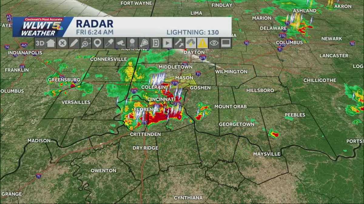
A weather front moved in from the west on Thursday and has decided to park itself right over Greater Cincinnati. Think of it like a stalled car blocking the road—this front isn’t moving anytime soon, and it’s bringing repeated rounds of heavy rain and thunderstorms with it.
IMPORTANT WEATHER ALERT
A Severe Thunderstorm Warning is in effect until approximately 6:45 AM Friday for areas north of Cincinnati, including:
- Colerain
- Deerfield Township
- West Chester
Take shelter indoors if you’re in these areas!
| Group | Why It Matters |
|---|---|
| Outdoor event-goers (VOA Country Music Fest, etc.) | Lightning + heavy rain = safety risk |
| Drivers | Ponding on roads, reduced visibility |
| Parents & pet owners | Sudden storms = scared kids/pets |
| Campers & hikers | Flash flooding possible in low areas |
| Day | Forecast | Risk Level |
|---|---|---|
| Friday | Downpours & storms, especially PM | High |
| Friday Night | Scattered rain continues | Moderate |
| Saturday | More downpours, front exits evening | High |
| Sunday | Dry & quiet | Low |
| Mon–Wed | Rain returns, heavy at times | Moderate-High |
Bottom line: Keep the rain gear close Friday and Saturday. Sunday is your dry window. Next week looks wet again.
No — expect waves of rain with breaks in between. But any storm that forms could bring heavy downpours and lightning quickly.
As of now, no official cancellation — but organizers are monitoring closely. Have a shelter plan if you’re attending.
A cold front stalled out over us. It acts like a trigger for storms — warm, moist air rides up along it, creating repeated rain chances until it finally moves.
Not necessarily! Just stay weather-aware. Have a way to get warnings (phone alerts, weather app) and know where to go if storms roll in.
Sunday looks great. After that, the pattern stays active with rain chances Mon–Wed. Keep checking the forecast — things can change!
Stay safe, stay dry, and don’t forget to check on neighbors who might need help preparing!