

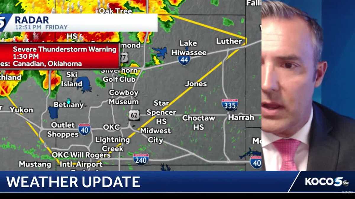
Severe Threat: 70 MPH Winds Slam Oklahoma Friday
Severe Storms and Scorching Heat: What Oklahoma Needs to Know for Friday
The Big Picture
Oklahoma is in for a double whammy on Friday: dangerous heat across the state plus a chance of severe storms in the north. Think of it like nature turning the oven on and shaking a soda bottle at the same time.
Important: Triple-digit temperatures and even hotter "feels-like" temperatures will stick around Friday and through the weekend. Stay hydrated and limit outdoor activity!
Severe Storm Risk: Who, What, Where, When
Who’s at Risk?
The northern half of Oklahoma is now under a Level 1 "Marginal Risk" for severe weather. That’s the lowest level on the 1-to-5 scale, but it still means storms could get nasty.
Cities and areas in the risk zone:
- Elk City
- Clinton
- Oklahoma City (OKC) metro
- Shawnee
- Seminole
- Areas north of McAlester
What Could Happen?
If a storm fires up near you, it could bring:
- 70 mph straight-line winds — that’s hurricane-force! Strong enough to snap trees, damage roofs, and knock down power lines.
- 1-inch hail — about the size of a quarter. Can dent cars and damage roofs.
- Flash flooding — heavy rain in a short time, especially in low-lying areas.
Good News: No tornado risk with these storms.
When Will Storms Arrive?
Here’s the timeline, step by step:
- By 3:00 PM Friday — Thunderstorms and scattered showers pop up in western Oklahoma and drift toward the OKC metro.
- By 7:00 PM Friday — Storms push south into southwestern Oklahoma and the Texas Panhandle.
- Around 10:00 PM Friday — Rain chances weaken, but scattered showers may linger in southern and eastern Oklahoma.
- Overnight — Showers move out, leaving behind a hot weekend.
The Heat Isn’t Letting Up
Even if storms miss you, the heat won’t.
- Actual temperatures: Triple digits (100°F+)
- Feels-like temperatures: Even hotter (heat index)
- Duration: Friday through the weekend
Important: Heat like this can be dangerous. Drink water before you’re thirsty, check on neighbors, and never leave kids or pets in cars.
How to Stay Informed
| Resource | What You Get |
|---|---|
| KOCO Weather Page | Live radar, forecasts, alerts |
| KOCO App | Push notifications for warnings |
| KOCO 5 YouTube | Live streams and video updates |
| Morning Newsletter | Daily forecast delivered to your inbox |
Meteorologist Jonathan Conder and the KOCO 5 First Alert Weather Team (led by Chief Meteorologist Damon Lane) are tracking this system live. Fun fact: They’ve been named Most Accurate Forecast in OKC for 14 years in a row by WeatheRate!
Your Friday Safety Checklist
- [ ] Charge your phone and enable weather alerts
- [ ] Secure outdoor items (trampolines, patio furniture, grills)
- [ ] Park cars in a garage or covered spot if possible (hail protection)
- [ ] Know your safe place — interior room, lowest floor, away from windows
- [ ] Have multiple ways to get warnings (app, TV, weather radio)
- [ ] Check on vulnerable neighbors (elderly, those without AC)
- [ ] Stay hydrated — water, not soda or alcohol
Summary
| Threat | Area | Timing | Main Hazards |
|---|---|---|---|
| Severe Storms | Northern OK (Elk City → McAlester) | 3 PM – 10 PM Fri | 70 mph winds, 1" hail, flash flooding |
| Extreme Heat | Statewide | Fri – Weekend | Heat exhaustion, dehydration |
| Tornadoes | None expected | — | — |
Bottom line: Friday is a weather-aware day. Storms won’t hit everywhere, but where they do, they could be intense. Meanwhile, the heat is a guarantee for everyone. Plan accordingly.
FAQ: Your Questions Answered
1. What does "Level 1 Marginal Risk" mean?
It’s the lowest severe weather category (on a scale of 1–5). It means isolated severe storms are possible, but not widespread or long-lived. Think "a few bad apples" rather than "the whole orchard."
2. Will my town get hit?
Storms will be isolated — like popcorn popping. Most towns in the risk zone won’t see severe weather, but a few will. That’s why you stay alert even if skies look calm.
3. What’s the difference between straight-line winds and a tornado?
Straight-line winds push out in one direction from a storm (like a giant fan). Tornadoes rotate. Both can do serious damage, but straight-line winds are more common in this setup.
4. Should I cancel outdoor plans?
If you’re in northern OK: Have a backup plan. Keep an eye on radar after 3 PM. If storms approach, head indoors. If you’re in southern OK: Heat is your main concern — hydrate and take shade breaks.
5. How do I get warnings if the power goes out?
- Weather radio (battery-powered)
- Phone alerts (make sure "Emergency Alerts" are ON in settings)
- KOCO app with push notifications enabled
Stay safe, Oklahoma! The KOCO 5 First Alert Weather Team has your back.


