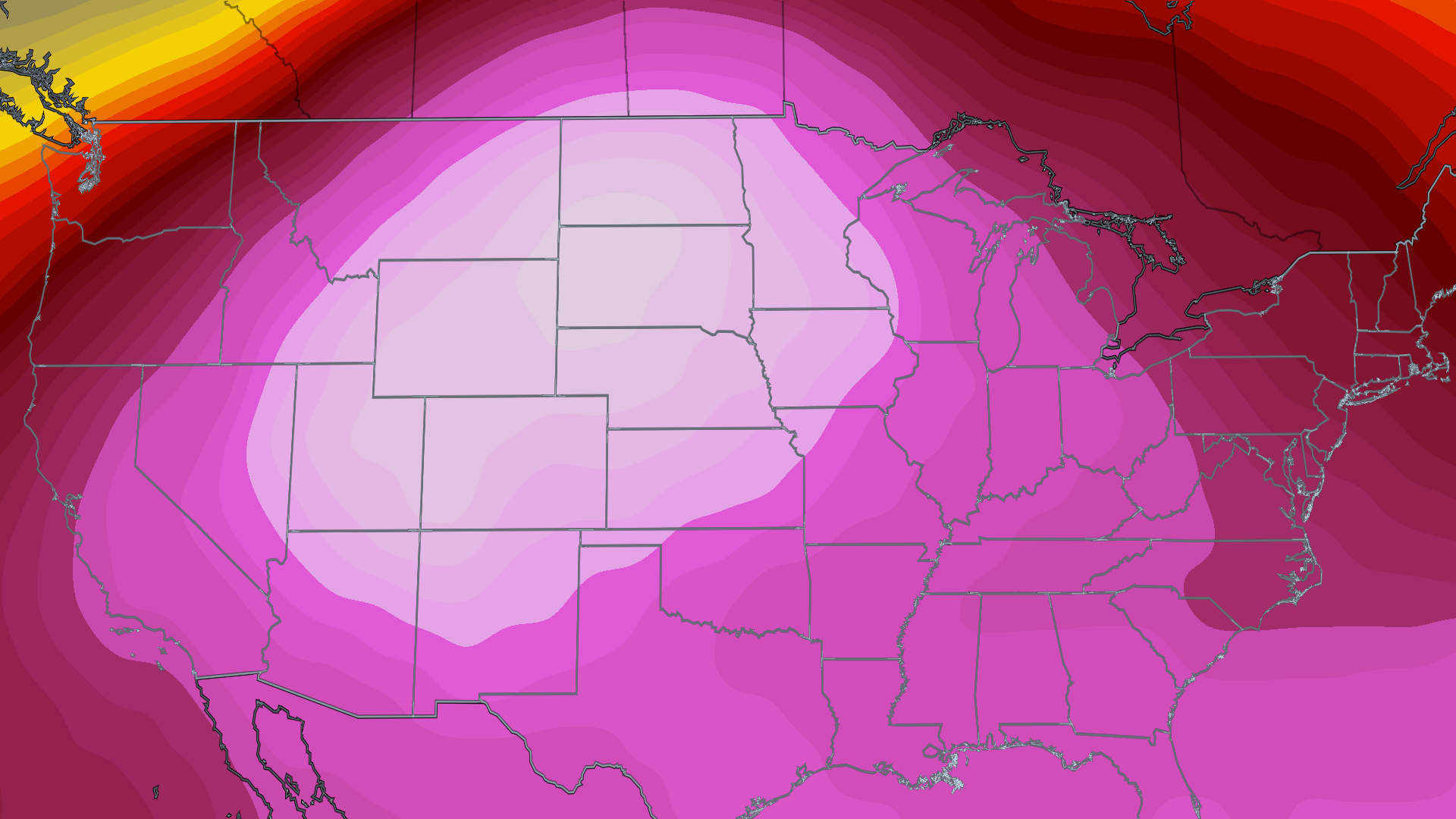
Rockies on Brink: Heat Wave Could Top All-Time Highs
Dangerous Heat to Bake the Rockies and Plains Into Next Week
What Is Going On? (The Big Picture)
Imagine a giant invisible lid in the sky, like a dome, that traps hot air close to the ground. Weather scientists call this a heat dome. Right now, a heat dome is getting ready to make it super hot in some parts of the United States.
- Starting this weekend, the heat dome will break record-high temperatures in the northern Rockies and Northern Plains.
- Next week, that super-hot and sticky air will spread to the Midwest and the East.
- Many famous national parks will feel this heat, including:
- Glacier
- Yellowstone
- Grand Teton
- Badlands
- Theodore Roosevelt
- The "Mighty 5" parks in Utah
- If you are visiting these parks this weekend, get ready — it will be much hotter than you might expect!
Important Point: A heat dome is like a pot lid that keeps heat from escaping. It can make the air below dangerously hot.
Rockies and Northern Plains Forecast
Heat Alerts: Watches and Warnings
Extreme heat watches and warnings are already posted from Utah to parts of the Dakotas and northern Minnesota.
- Extreme Heat Watch: This is given when the weather folks think a super-hot event that could make people sick (like heat exhaustion or heat stroke) is likely in the next 24 to 48 hours.
- Extreme Heat Warning: When they are really sure it will happen, the watch is changed to a warning.
Callout for Important Points:
If a warning is issued, it is time to plan to stop all big outdoor activities.
If you do not have air conditioning (AC), you should:
- Find the nearest cooling shelter (a place with AC where people can stay cool), or
- Talk to family or friends nearby who have AC and see if you can stay with them.
How Hot Will It Get?
- In parts of Utah, Idaho, Wyoming, Colorado, Montana, and the Dakotas, the daily high temperatures will shoot into the triple digits (100°F or more) every day through Monday, and maybe even Tuesday.
- A few spots in the northern High Plains could reach or go past 110°F.
- In some areas, especially bigger cities, the early-morning low temperature might not drop below 70°F — so nights stay warm.
- Some modest (small) relief from the heat may arrive Tuesday through Thursday.
Will Records Be Broken?
These forecast highs might not just beat the record for a single day — they could approach, tie, or even top the hottest temperature ever recorded in some Rocky and Northern Plains locations.
- Salt Lake City could come close to its all-time record of 107°F. That record was set on five different days, most recently on July 17 and September 7, 2022.
- Billings, Montana could see its first high in the 110s in 92 years of record-keeping (records go back to 1934).
- Billings is just one of almost two dozen locations in eastern Montana and Wyoming that could flirt with their all-time record highs.
Midwest and East Forecast
When Will the Heat Get There?
Here is the simple timeline:
- This weekend: The upper Midwest (especially Minnesota) feels the hotter weather first.
- By Monday: The hot, humid air mass slowly moves through the rest of the Midwest.
- By Tuesday: The East Coast gets the heat.
How Hot Will It Get in These Areas?
- Many places will see afternoon temperatures climb into the 90s.
- A few areas in the mid-Atlantic and Midwest could get near 100°F around the middle of the week.
- Some daily records could be set on Tuesday and Wednesday in parts of the Northeast — from New England and upstate New York to the mid-Atlantic states.
- In larger cities, the morning low temperatures may stay in the middle or upper 70s, meaning little cool relief in the evening or at night.
Important Point: Heat is actually America’s deadliest weather — more deadly than tornadoes or hurricanes. Always take heat seriously.
When Will Relief Arrive?
- Weather computer models suggest a fairly strong cold front (a boundary that brings cooler air) might drop down from eastern Canada into the Northeast on Tuesday into Wednesday.
- That could bring heat relief from the northern Great Lakes to New England by the middle to late part of the week.
- But ahead of that front, there could be severe thunderstorms with damaging winds.
Simple Steps to Stay Safe If a Heat Warning Is Issued
If officials issue an extreme heat warning, here is what to do (in easy steps):
- Pause outdoor plans — suspend all major activities outside.
- Check your AC — if you don’t have air conditioning, locate the nearest cooling shelter.
- Reach out — talk to nearby family or friends who have AC and ask if you can stay with them.
- Stay aware — listen to updates, because heat can make people very sick.
Summary
A big heat dome is about to trap hot air over the northern Rockies and Plains this weekend, breaking many records and making national parks extremely hot. Then, the heat will slide east to the Midwest and East next week. Some places may see temperatures over 110°F, and even nights will stay warm. A cold front may bring relief late next week but could also cause storms. If you are in these areas, watch for heat alerts and have a cool plan ready!
FAQ
1. What exactly is a heat dome?
A heat dome is like a giant lid in the atmosphere that traps warm air near the ground, letting it heat up even more — similar to how a lid on a pot keeps heat inside.
2. Which national parks should prepare for the heat this weekend?
Glacier, Yellowstone, Grand Teton, Badlands, Theodore Roosevelt, and Utah’s "Mighty 5" parks are expected to be hit by the heat wave.
3. What is the difference between a heat watch and a heat warning?
A watch means dangerous heat is possible in the next day or two. A warning means it is very likely or certain, and you should take action right away.
4. When will the East Coast feel the heat?
The hot air is expected to reach the East by Tuesday of next week.
5. How can I stay safe without air conditioning?
Find a local cooling shelter or arrange to stay with friends or family who have AC, and avoid big outdoor activities during the warning.