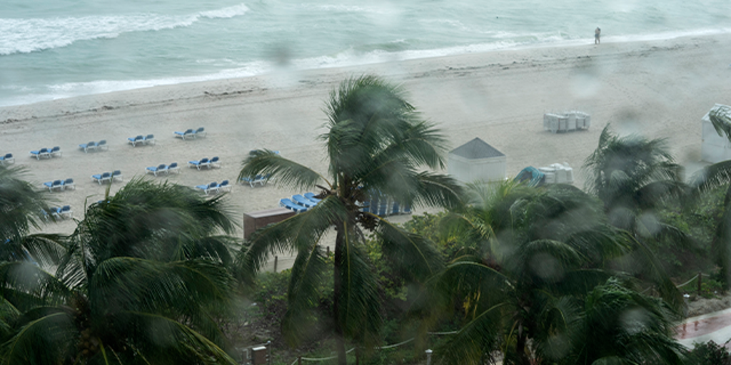
NHC Alert: New Tropical Threat Brews Near Florida, Southeast Coasts
New Area to Watch for Possible Tropical Storm in the Atlantic
What’s Going On? (Explained Like You’re 5)
The National Hurricane Center (NHC) – a team of weather grown-ups who watch the oceans – has found a new spot where a storm might start to grow.
This spot stretches:
- From the Gulf waters off Florida’s "Big Bend" (the curved part of Florida’s panhandle)
- Across the Florida peninsula
- All the way to the coasts of Georgia and South Carolina
Right now, they say there is a low chance that a tropical storm will form here, but they are keeping their eyes on it.
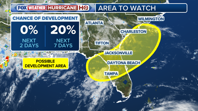
Area to watch for tropical development. (FOX Weather)
When Will We Know More?
An area of low pressure (imagine a gentle swirl of air where the air pressure is a bit lower than around it – like a tiny weather seed) is expected to appear over this region during the weekend.
The FOX Forecast Center (another team of weather experts) said:
"As of right now, there is no immediate threat or even an area of low pressure to track."
They also said this is the same area they were already closely monitoring for potential development earlier this week. Once that low-pressure swirl actually forms, they’ll have a better idea about:
- Timing – when the rain might come.
- Impacts – how much tropical downpour (heavy warm rain) might hit Florida and potentially up the Southeast coast.
What Does "Tropical" Mean? (ELI5)
A weather system is called "tropical" when it meets these simple rules:
- Thunderstorms are well-organized (like neatly arranged clouds instead of messy ones).
- They rotate around a distinct center (like a spinning top).
- It all happens over warm water (like a heated swimming pool).
So, a tropical system is basically a tidy, spinning pinwheel of rain clouds over warm sea water.
Will It Rain Even If No Storm Forms?
Yes! Here’s an important point:
Important: Regardless of any tropical development, people in northern Florida and other parts of the Southeast will likely see tropical downpours from this system.
The Exclusive FOX Weather Tropical Threat map (shown below) says the chance of development is low, but the odds are slowly going up.
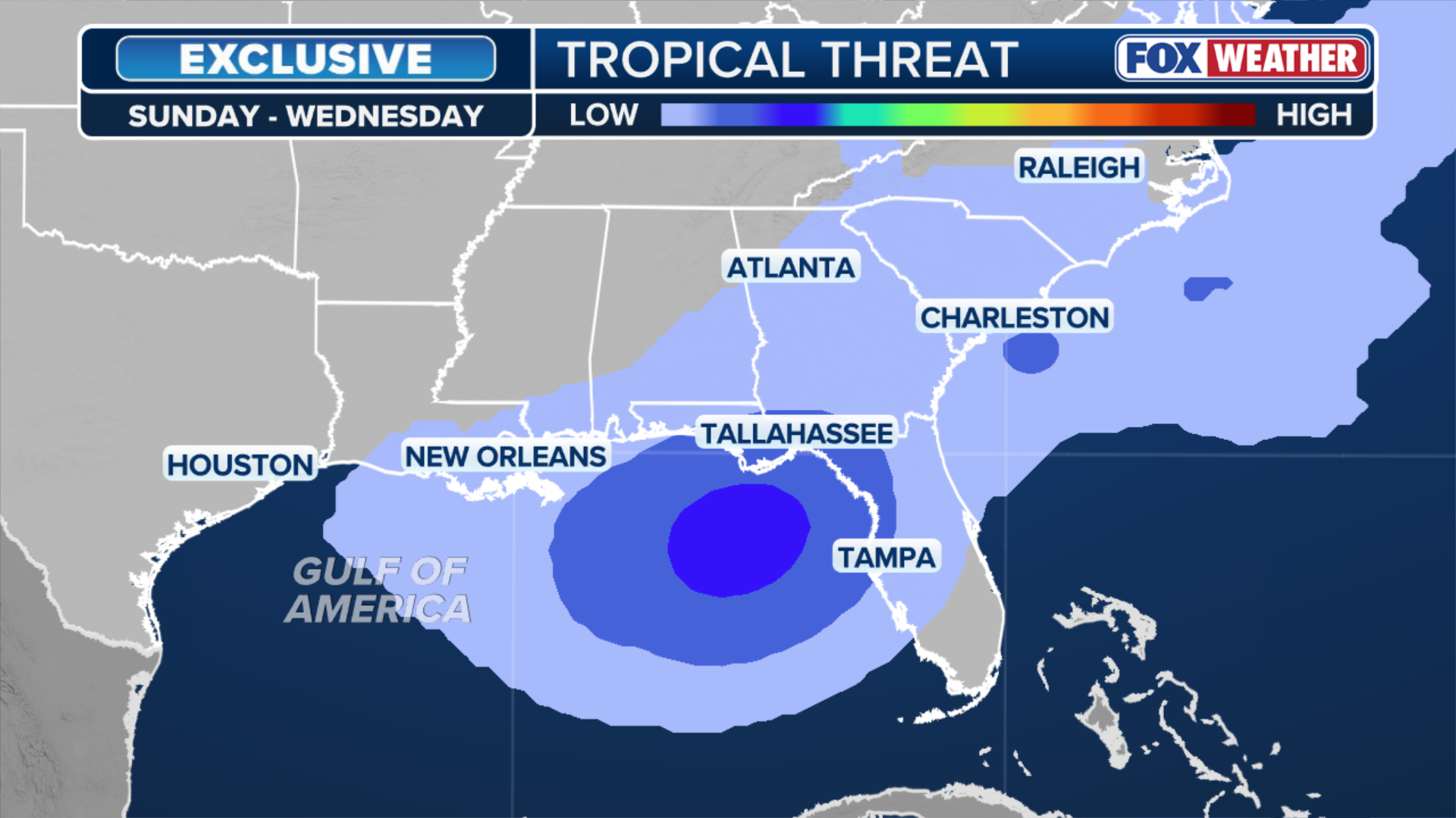
Exclusive FOX Weather Tropical Threat (FOX Weather)
Why July Storms Are Like "Homegrown" Veggies
Historically, most storms that pop up in July are called "homegrown threats". That just means:
- They grow close to the American coastline (like plants in your backyard) instead of far away in the deep ocean.
Right now, the water in the Gulf and off the Southeast coast is warmer than average – which is like extra fertilizer for storms.
What’s Happening in the Open Atlantic?
While the near-coast area is being watched, the wide-open Atlantic (far from land) is having a quiet start to the season because of unfriendly conditions:
- Hostile winds that rip storms apart.
- Plumes of Saharan dust (tiny sand from the Sahara desert in Africa that flies across the ocean and dries the air).
- Average water temperatures (not warm enough to help storms).
Recap of Tropical Storm Arthur
- Tropical Storm Arthur formed along the Texas coast on June 17, 2026.
- It brought flooding to places like Freeport, Texas, where floodwater surrounded neighborhoods after it made landfall.
- It is the only named storm thus far this year and the first named storm of the Atlantic hurricane season.
- The next named storm in the 2026 Atlantic hurricane season would be called "Bertha."
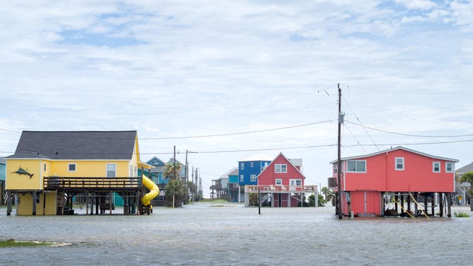
FREEPORT, TEXAS – JUNE 17: Floodwater surrounds a neighborhood after Tropical Storm Arthur made landfall on June 17, 2026 in Freeport, Texas. A Tropical Storm Watch has been issued for portions of the northwestern Gulf Coast, stretching from the mid-to-upper Texas coast into Louisiana, as Tropical Storm Arthur brought heavy downpour and flooding. Tropical Storm Arthur becomes the first named storm of the Atlantic hurricane season. (Photo by Brandon Bell/Getty Images)
Callout: Key Things to Remember
Stay Weather-Aware:
- NHC is watching from Florida’s Big Bend to the coasts of Georgia and South Carolina.
- Low pressure may form this weekend – low chance now but odds steadily increasing.
- Heavy rain likely for northern Florida & Southeast regardless.
- Next storm name: Bertha.
- FOX Weather is your Hurricane HQ – check back for updates on this developing story!
Summary
To wrap it up in a nutshell:
- The NHC flagged a zone from Florida’s Big Bend across the peninsula to Georgia and South Carolina for possible tropical development.
- A low-pressure area may form over the weekend, but currently the chance of a tropical system is low.
- Even without a named storm, tropical downpours are expected in northern Florida and the Southeast.
- July storms often form near the coast ("homegrown") and nearby waters are warmer than average.
- The open Atlantic is quiet due to dust, hostile winds, and average temperatures.
- Arthur was the first named storm; Bertha is next on the list.
- Experts will keep watching and updating.
FAQ
1. What is the National Hurricane Center (NHC)?
It’s a group of scientists and forecasters who monitor the oceans for hurricanes and tropical storms to keep people safe.
2. What is an "area of low pressure"?
It’s a region where the air pressure is lower than the surrounding area, often a starting point for clouds and storms to spin up.
3. What is Saharan dust?
It’s fine sand from the Sahara desert in Africa that travels across the Atlantic. It can block storms from forming by drying out the air.
4. What does "homegrown threat" mean?
It means a tropical storm or hurricane that develops close to the U.S. coastline rather than far out in the open ocean.
5. Will a hurricane definitely hit?
No. Right now the chance is low, but rain is likely anyway, and the situation could change. Always stay tuned to weather updates.